Tag Archives: The Haldimand Norfolk Archaeological Research Project (HNARP)

Fossil Shows Canada Had 400 Day Long Year

Haldimand and Norfolk Counties in Ontario, Canada have become an attractive area to explore for marine fossils.

The Great Lakes Basin, once inundated by a vast ancient, shallow sea that covered much of central North America, is today revealing an abundance of fossil corals, invertebrates, and marine organisms found within many limestone formations uncovered by glaciers and erosion.

Haldimand and Norfolk County have especially become an attractive area to explore for fossils of marine organisms by both scientists and amateur fossil collectors who can travel to local locations such as Rock Point Provincial Park near Dunnville, Ontario.

However, these fossils represent more than just evidence of unique life forms that once numbered in the tens of thousands of species co-existing in a marine ecosystem. They are scientific evidence of marine ecosystems in ecological transition, shifting continents, changing climates, and a record of our planets’ every day rotation around the sun.

Many fossil corals found in Haldimand and Norfolk County date around 410 to 360 million years ago. It is a time geologically known as the “Devonian Period”, the “Devonian Reef” or the “Age of Fishes”. During this period, fishes of many different species became abundant in the fossil record. A partly submerged North America, or as yet to be formed Great Lakes Basin, was colliding with Europe close to the equator. Reef building environments began to develop and produce some of the largest reef complexes in the world.

The reef complexes were in large areas of shallow equatorial seas that existed between the continents.

Evidence of a saltwater sea supporting a vast coral reef system once covering southern Ontario over 400 million years ago in the form of fossilized coral deposits support the theory that a coral reef system existed for a very long time. It was in the basins of these former shallow seas that great quantities of rock salt, gypsum, and other types of minerals precipitated, and today, mining industries dig well below the lowest depths of Lake Erie to recover these minerals.
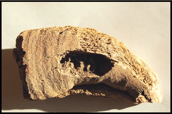
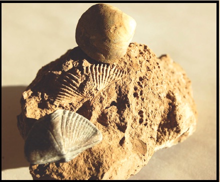
The “Heliophylum halli” is a fossil particular to the Great Lakes region and studies of its growth rings revealed 400 days in one Earth year when this coral was alive.

Exposure of reef basins varies and depends on how glaciers or water erosion has pushed or washed soil off bedrock. Under these conditions, a geologist’s field magnifying glass can help find very small fossils such as radiolarians and diatoms. Otherwise, larger fossils such as different varieties of bivalves (clams), trilobites, and even large fragments of fossilized coral are exposed. In some case, there are discoveries of fossilized marine organisms that are both rare and some times difficult to identify.

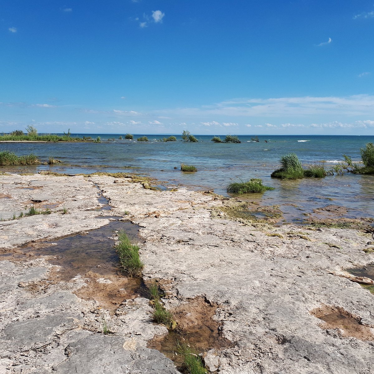
The fossilized remains of a Devonian Reef. Rock Point Provincial Park, Ontario.ROCK POINT PROVINCIAL PARK (Dunnville) - 2022 What to Know BEFORE You Go

What ended these reef complexes and created one of the greatest mass extinction events of earth’s biota was a combination of events that took place over a period of 25 million years.

Since species rely on a warm water marine ecosystem for their survival it would seem that a slow and gradual continental shift north from the equator would over time impact a large variety of marine species, including those supported by coral reefs. Therefore, events such as shifting continents, lowering of sea levels, climatic changes influencing land and sea ecologies, and/or possibly a glaciation had significant roles in the extinction of earth’s biodiversity.

Devonian Period - Geology Page
The large deposits of fossil corals and invertebrates found in Norfolk and Haldimand County has been of great interest to scientists and fossil collectors for many decades. However, fossil collecting took on a new importance in the last 50-60 years when it was determined there was a connection between growth rings of coral skeletons with the number of days in a year.

Scientists studying samples of coral skeletons from contemporary coral reef systems discovered growth rings on the outer surface of coral skeletons.

By studying a large sample of coral skeletons and determining how many growth rings represented a year’s growth of calcium carbonate, scientists were able to calculate an average of 360 rings per year. Thereby, approximately one growth ring represented one day’s growth for each day of the year. Taking this new information, scientists began collecting large numbers of exceptionally well-preserved coral fossils belonging to the Late Devonian Period. One particular species, found in the Great Lakes region, called a “Heliophylum halli” (see above) exhibited many growth rings developing in one year during this period. The result surprised even scientists.

Fossil coral showed there were approximately 400 growth rings per year 370 million years ago. Therefore, there were about 400 days in a year in the Devonian Period. Astronomers who have calculated that our earth’s rotation has been slowing at a rate of about 2 seconds every 100,000 years have since supported the new information.
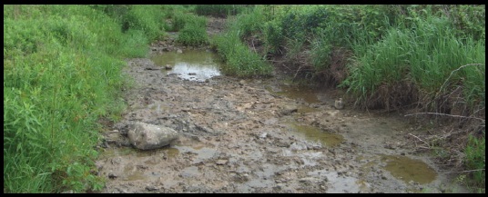
Exposures of ancient reef basins can be discovered in dried up stream beds and even under farmers fields.

Despite Haldimand and Norfolk County being a small example of a region once holding a thriving coral reef system, existing over 400 million years ago, the number of fossils of different species exposed is vast. Fossil corals, invertebrates, and species of marine organisms exist in many different shapes, sizes, and can be very fragile. Therefore, whether you are a scientist or amateur fossil collector, the next time you take a walk across the landscape to explore and search for fossils be sure to take along a fossil guide. You never know what new fossil discoveries you might make just walking across the countryside for an afternoon. For the Silo, Lorenz Bruechert.

Ancient Arrowheads Made From Ancient Haldimand Stone

I am sure some of  you may have heard this story before, a friend goes out for a walk in the forest and returns back later holding what appears to be an arrowhead.  Conversations about the artifact are followed with curiosity to learn more.  Questions are asked such as, who made the artifact? How old is it? What type of rock was used to make it?  How was it used?

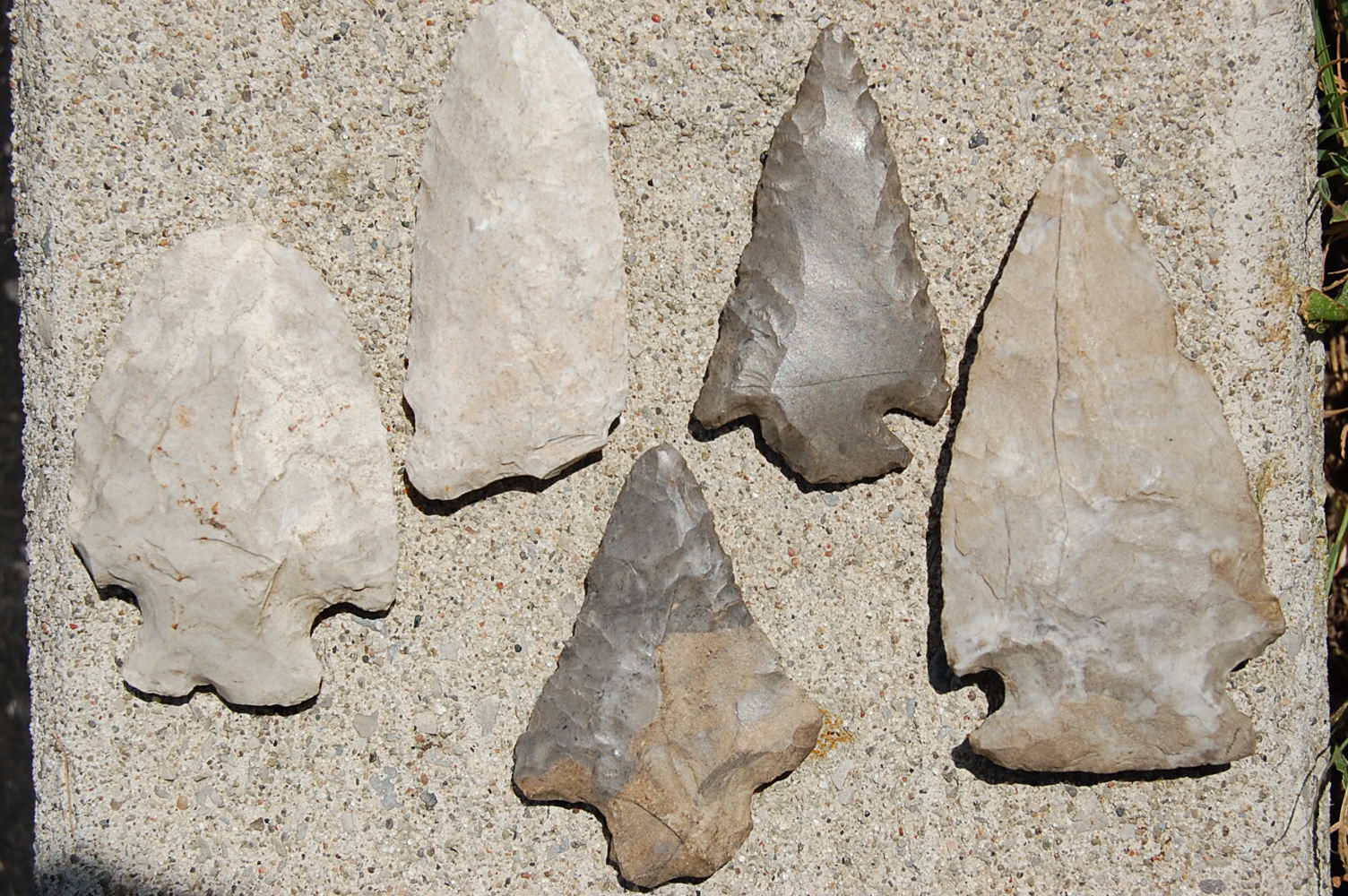
For most people, arrowhead is a popular name used to describe the artifact they have found.  In archaeology, arrowheads are generally called projectile points, but we will call them points for now.  However, names are given to different types of points based on how archaeologists think they were used.  Depending on their weight, size, and shape points can be called a spear, dart, or arrow point.  Spear points are normally heavy, large, measure between 8cm to 17cm in length, and most likely tipped the end of a long wooden shaft.  Dart points tend to be thick in the middle, light in weight, usually measure from 4cm to 8cm in length, and tipped the end of a long narrow wooden shaft thrown with the help of a dart-thrower.  Arrow points are almost always triangular in shape, very thin in the middle, very light in weight, measure 2cm to 4cm in length, and hafted to a short narrow wooden shaft fired from a bow.

So who made these artifacts?

In most cases, they are referred to as Indians.  In fact the name Indian was given to the first people met by Europeans arriving in the New World because at first they thought they had landed in India.  The name has stayed ever since.  Aboriginal is a name used by anthropologists and archaeologists alike when discussing the first people to the New World.  We now know Aboriginals lived a hunting-gathering life style whether they lived nomadic or sedentary life styles.  We don’t know the original names of Aboriginal groups, but names have been given to their points to distinguish one type from another.  Some example names like Hilo, Nettling, and Genesee have been created for specific types of points.

Just how old projectile points are is determined using a technique called radiocarbon dating when uncontaminated organic material is recovered next to a point.

Archaeologists have been able to determine when a point was made in a specific time period based on the results of radiocarbon dating methods, but these are approximate dates.  In Canada, the oldest known points are called Clovis points dating up to 11,200 years ago.  Similar points have been found in the Great Lakes region dating around 10, 600 years ago.

Most projectile points found in the Lake Erie region of  Norfolk and Haldimand County are made from a sedimentary rock high in silica called chert giving the stone a glassy ring to it when two pieces are hit together.  What is unique to this region is that almost all points found in Norfolk County were made from chert originating from Haldimand County.  Aboriginals either made their points in Haldimand County or picked up chert as rectangular nodules and carried it in tumpline baskets into Norfolk County where stone tools were made, including points.

Chert was only one of several materials used to make these points.  Other materials such as wood, bone, and antler were also used, but because they are organic materials most of these points have decomposed over time.  There were some attempts to make points from metal such as natural copper, but after contact with Europeans arrow points began to be made from metal products traded with Aboriginals.

Most often projectile points were used to hunt animals because they could create a serious wound to an animal to slow it down, but they were also useful as other types of tools.

While points are sharply tapered, many are wide with rounded or curved cutting edges suggesting as use other than hunting animals.  Many points were used every day as knives, scrapers, and even drills because the chert they were made from produced a very sharp edge.  However, the one problem with all points is that they break frequently during use and need repairing on a regular basis.  This would explain why many broken projectile points been found.

Why are so many projectile points different from one another? 

Archaeologists suggest points were used to distinguish one group of people from another.  The abundance of points also suggests many were made for the purpose of exchanging and bartering for other resources, especially if they were made from a chert that was considered exotic in colour or resistant to breakage.  In fact, chert found along the Onondaga escarpment in Haldimand County and ends in southern New York State was widely transported and exchanged because it was resistant to breakage compared to other types of chert.  Lastly, point styles may reflect a response by Aboriginals to adjust the shape or style of the point to changing environments and food resources.

So the next time you get a chance to visit a museum with Aboriginal artifacts with a friend who found a projectile point, or maybe you found a point yourself, think about the amount of history held within this one artifact.  Remember, it was made by a person who once lived, breathed, and walked across the very same landscape you live on today.  If you look closely at a projectile point imagine what stories it could tell you about the past. For the Silo, Lorenz Bruechert.


MTO Explain Archaeological Delays For Ontario Bridge

Eg's of type artifacts found in Cayuga area.
Eg’s of type artifacts found in Cayuga area.

Silo/HNARP- Can you tell our readers a bit about the history of the bridge, for example the year in which it was first built and its age?
The Grand River Cayuga Bridge is a 5-span through-truss bridge. Construction began in 1923 and was completed in 1924.

Silo/HNARP- So why is the bridge being redesigned and rebuilt?
To ensure our provincial bridges remain safe, Ontario is the only province in Canada to legislate that owners must inspect their bridges every two years by, or under the direction of a professional engineer. Taking it one-step further, MTO also conducts routine maintenance inspections of all 2,720 of our provincially owned bridges every year.
As part of our assessment, the Grand River Bridge, while currently still in safe condition, was identified as requiring future replacement, due to its age and declining condition. In 2005, the ministry initiated a Preliminary Design and Class Environmental Assessment (EA) Study to determine the long-term strategy for the bridge. Completed in 2008, the Study recommended the bridge be replaced with a 5-span, steel girder bridge. The Study received Environmental Clearance in November 2008.

Silo/HNARP- Can you explain to us the importance of archaeology to the MTO in Ontario and its support of the Heritage Act?
It is a requirement of the Ontario Heritage Act to address the impacts of any project on both archaeological resources and the built heritage environment, MTO achieves this as part of the Environmental Assessment we conduct for every MTO undertaking.

Silo/HNARP- Is the archaeology holding back the bridge’s development or is the project on schedule?
The ministry’s preliminary design and Class EA identified prehistoric and historic archaeological sites along the west side of the existing bridge, so it was acknowledged that some special measures and precautions would be necessary. The archaeological salvage work has been scheduled into the timeline of the project, and is on track.

Silo/HNARP- Did the MTO know in advance that extensive archaeological work was necessary?
The archeological assessment completed during the EA Study identified that prehistoric and historic archaeological sites are located along the west side of the existing bridge. Based on the results of a Stage 3 archaeological assessment (test trenches) completed during Preliminary Design, it was determined that a Stage 4 Archaeological Salvage had to occur to ensure existing artifacts are recovered before any areas are disturbed as a result of construction. In 2009, the ministry started the detail design study and retained a consultant (McCormick Rankin Corporation) and their sub-consultant, New Directions Archaeology Ltd., who are responsible for completing Stage 4 Salvage under an archaeological license issued by the Ministry of Tourism and Culture (MTC).

Silo/HNARP- The general public has noticed the excavation taking place one layer at a time. Why has this been important?
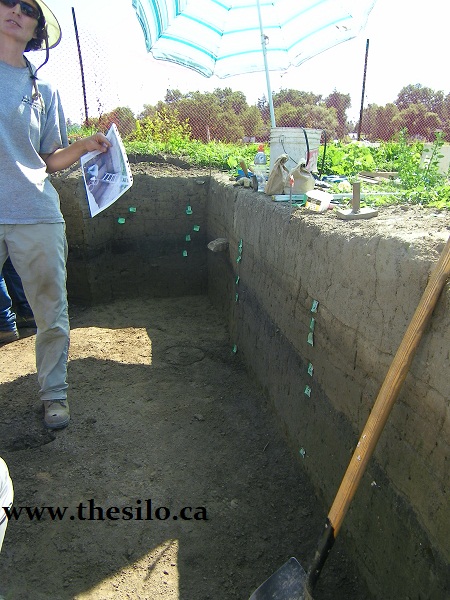
This is a very significant archaeological site made up of a series of cultural layers representing different historic and pre-contact occupations at this location. Based on previous studies, the artifacts range in age from the Archaic period, circa 8000 – 1000 B.C. through to the historic period circa 1700+ A.D. The west bank of the Grand River around Cayuga is a flood plain. Because the periodic flooding of the Grand River deposited silt over this flood plain, this site is made up of numerous levels of cultural material, each dating to a specific time frame, sandwiched between sterile layers of flood deposits. The goal of the excavation is to map and record these cultural layers before they are impacted by construction. To do this, the excavation is being completed in one metre by one metre squares, recording the original location of each artifact within the one metre square, including the depth at which it was recovered. The artifacts from each one metre square will be kept together, with individual levels kept separate in clearly identified bags. This will ensure that each artefact will be related to a specific cultural level and time period, to interpret the history of the site.
The excavation of each one metre square will continue downward until no further artifacts are recovered. Based on previous test excavation on the site, this will be at a depth of about 160 cm. The excavation will continue below this depth to ensure that all artifacts have been recovered, generally to a depth of approximately 180 cm (1.8 m).

Silo/HNARP- What unique discoveries have resulted at the site such as historic, pre-contact, archaic items?
The site is yielding an array of artifacts, including ceramics (pottery), tools (scrapers, spear points, arrow heads), stone flakes from tool making and even a shell bead, thought to be an early trading item.

Silo/HNARP- Why has the Six Nations been involved with this project?
First Nation involvement is an important aspect of this project because of the significant archaeological resources at this site. MTO and our consultants have regular and ongoing consultation with interested First Nations regarding this project. People from Six Nations have been hired for the archaeological field investigations and monitoring of the salvage operations, as well as the follow-up lab work.

Silo/HNARP- What will the MTO do with the artifacts once the project is finished. Will there be any public education about what was found?
Once the excavation of each one metre square is complete, the artifacts will be removed from the site and taken to a lab where they will be washed and organized. The artifacts will be analyzed and discussed in a final report including conclusions about the prehistoric activities at this site. Given the scope of this excavation, the analysis and reporting of this site will take years to complete. Once the report is finished, the artifacts will be kept for posterity, available for other archaeologists who are interested in the site and the time periods represented. Discussions are currently underway with a few Ontario university repositories to house the artifacts.

Silo/HNARP- How and where can the community learn more about what was recovered and learned from the excavation when the project is finished? Is there for example, an online PDF document, field report or analysis report of artifacts?
A report will be prepared after the artifacts are analyzed. The report may take a few years to complete, due to the size of the excavation. It will be filed with MTC and also provided to the First Nations having an interest in the site. Due to local interest, we also expect to provide copies to local repositories, such as the Haldimand Museum.

Silo/HNARP- Will this be the last season of field work before the bridge reconstruction gets started or is another field season anticipated in 2012.
It is anticipated that the salvage work at the current site will be completed in the fall of 2011. Additional areas of archaeological salvage may occur in 2012, if it is determined that construction activities will cause disturbance to additional areas on the west side of the river not yet salvaged.

Silo/HNARP- Who can be contacted to learn more about this archaeological site and its history?
The salvage work and report preparation are being conducted by New Directions Archaeology Ltd., under the direction of Mr. Phil Woodley. Questions about the site should be directed to the Communications Coordinator for MTO West Region (519-873-4186), who will consult with Mr. Woodley for detailed information as required.

Silo/HNARP- When is work expected to begin on the bridge replacement?
Construction is anticipated to begin in 2012 and is expected to take two construction seasons to complete.

Ancient Stones Being Discovered

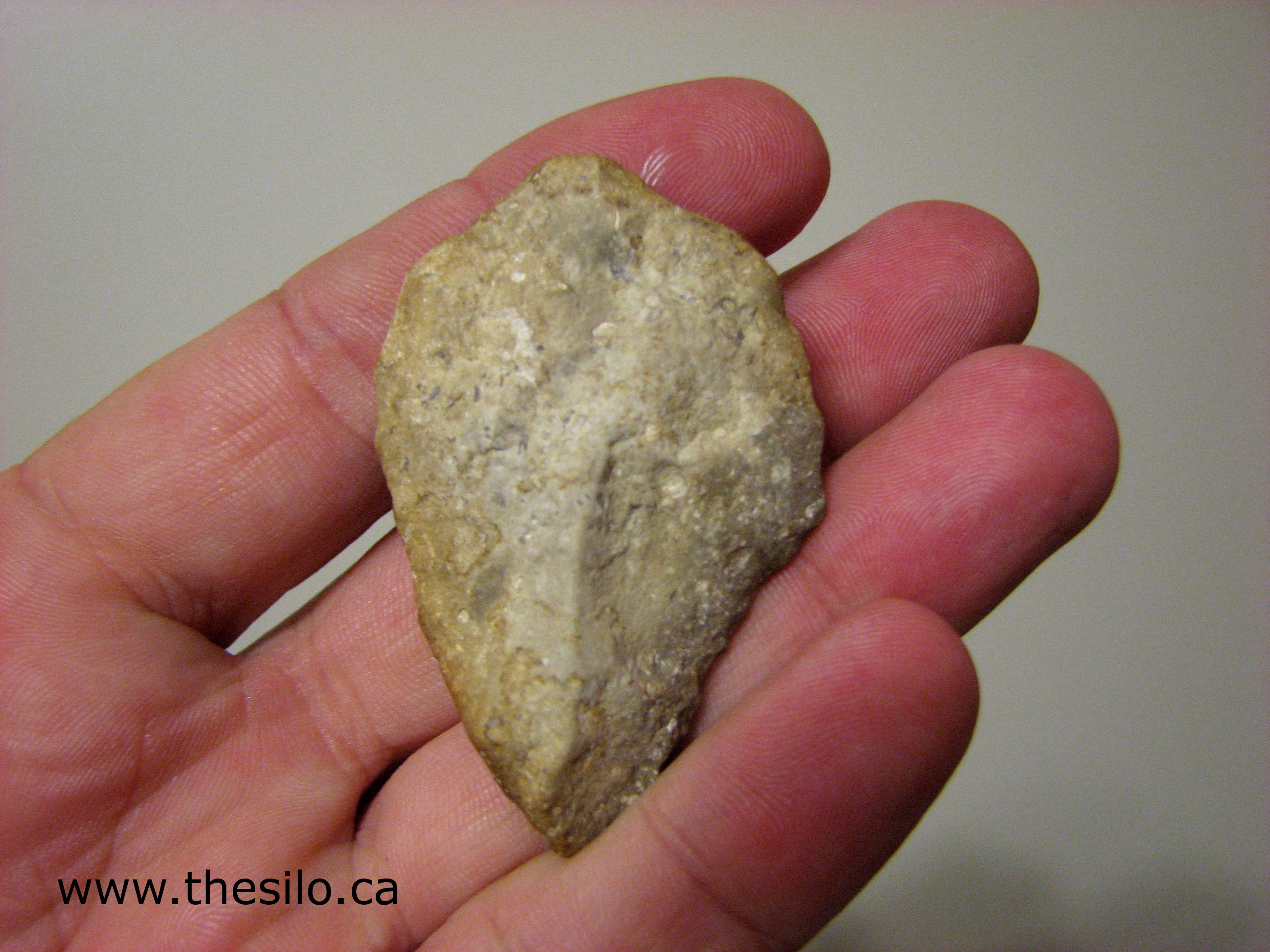
An artifact recovered near Port Dover, ON

Generations of Haldimand and Norfolk citizens have found and collected stone artifacts from their lands. Artifacts were kept out of intrigue and interest and often displayed prominently within homes. Some were valued as family heirlooms, others placed in boxes and kept packed away on a shelf. This is where I enter the story. My name is Lorenz Bruechert and I am an archaeologist.

Not long ago a land owner told me that artifacts had been collected from his family property over many, many years. I was invited to make an examination because the owner knew they might be important to my regional archaeological study (www.haldimandarchresearchproject.com). There still was a little hesitation, primarily out of concern that I might confiscate the artifacts. But that is not what I do. My interest in private collections from prehistoric times is based in public outreach and education.

I was able to provide the owner with a time period of the artifacts, the type of rock used in their manufacture, and their origins. You see, I believe it is important to foster trust and to empower landowners with information, thereby ensuring their collections are valued, respected and hopefully made available for scientific study.

Private collections reflect the richness of our homelands and confirm the reality of past human occupation. Trying to make sense of who primitive occupants were and how they lived is helped immensely by studying the ages and quantities of found artifacts. Artifacts date from within historic periods to as far back as when glaciers still existed in Southern Ontario. In fact, many land owners are surprised to learn that their collections are much older than a few hundred years.

At least 80% of human history is represented by stone artifacts. The rock used is generally a sedimentary variety containing silica. The more silica a rock has, the easier it is to break apart. The geological name for the type of stone used in most tool manufacture is chert or flint. Chert formations date as far back as the age of the dinosaurs. They were scoured and scraped by the movement of glaciers and carried along until the glacier melted. What this means is that an artifact found in Haldimand or Norfolk may have originated thousands of kilometers away!

In Southern Ontario, stone tool artifacts have been recovered and dated within several different main time periods. Each period shows variations thought to reflect climate changes that made an impact on animal and plant species. As species changed or disappeared, new types of stone tools were manufactured to keep up with these transitions. Dating artifacts, therefore, helps to identify migrations of different people groups across our counties’ deep past.

Most landowners truly enjoy having their artifacts interpreted. Their private collections remain intact and local people become, in a sense, guardians of local history. If a family is not interested in acting as stewards, I always encourage them to donate their pieces to a local museum, to ensure that the artifacts remain in the community.

Lorenz Bruechert will return soon for another installment of local archaeology. You can contact Lorenz at hnarproject@gmail.com.

Rural Ontario Archaeology

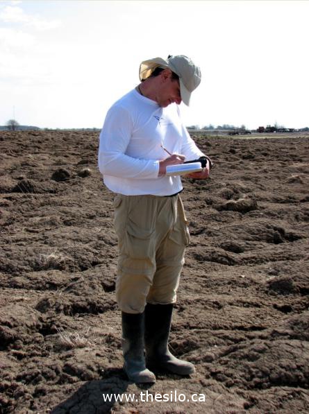
Lorenz taking notes in the field

I was raised in the dairy farming community of Jarvis in Haldimand County.  Since dairy was on the decline my family and I decided I would go to university. I began the study of archeology, and The Haldimand Norfolk Archaeological Research Project (HNARP) is a scientific study intended for my doctoral dissertation.

I selected this region because as a youth I walked across many of the county concessions and came to have an understanding of the landscape. In addition, there is continuous encroachment on the farm lands in the form of housing subdivisions in growing communities, industrial development along the lakeshore, and external landowners waiting to develop the land. The long term goal of the HNARP is to improve current evidence of prehistoric climate change and to determine its impact on early people. A study has never before been undertaken in Ontario over such a large parcel of land, and it needs to be done now before the opportunity is lost forever.

When the Laurentide ice sheet began receding 20,000 years ago the lands left behind were devastated by glaciers that destroyed plant life and any chance for animal or human survival. The first hints of people in the region date back 11,000 years. Evidence of their existence is in the form of stone debris and tools left behind on the ground. In fact,  Haldimand is the locus of our study because of the abundant chert formations in the region (chert is a type of flinty rock). These were a continuous draw for early people constantly in need of stone for tools and weapons. This same geology is the source of the quarry rock that provides jobs and careers in the community today.

Which brings us to one of the most rewarding outcomes of this kind of archeology: the people of Haldimand-Norfolk will begin to understand their relationship to the land as part of a 10,000 year history of human habitation. By systematically studying the major watersheds we can learn much of both archeological and environmental importance. Settlement patterns emerge. We begin to see how fluctuations in the climate of the Great Lakes region impacted plant and animal life, and the seasonal availability of certain foods. As we learn about the past we discover connections to the present, and can plan more effectively for the future. But the evidence we need can only exist under certain conditions, and development is not one of them. The HNARP must act now to learn what we can.

Our success depends on agricultural landowners acting as stewards, to preserve and protect archaeological sites so they can be properly interpreted and understood. People are often concerned about what an archeological study on their lands might mean. Let me alleviate some of those concerns. The HNARP regional study is conducted on private property. That means simply: your land remains your land. All information relating to this scientific study is strictly private and confidential. No information is made public or shared with any institution or public organization.  Generally, landowners can continue their farming practices without any interruption from this study.

One of the most interesting aspects of our work is something we call “community archaeology.” Interested community members can volunteer to be trained in to work with HNARP members, and become part of the discovery themselves.  For the Silo, Lorenz Bruechert.