Tag Archives: lake erie

Urbanization Of Rural Farm Land Threatens Archaeological Evidence

The Haldimand-Norfolk Archaeological Research Project was a regional study meant to discover new information about the past that has impacted the region such as; glaciers, climate change, prehistoric and historic settlements, wildlife, and geologic formations. 

The agricultural lands of Norfolk and Haldimand County combined is approximately 2,286.49 km2 and is identified as a zone of geologic, archaeological, and historical significance, promising to reveal a great deal about past environmental events and people.

Yet, the urbanization of agricultural lands continues to alter the landscape by removing evidence of forests, tributaries, reduced land elevations, current and past ecologies, and lastly, evidence that people and their descendants once crossed the landscape of this region.  For these reasons a regional study was initiated before this information is lost forever.

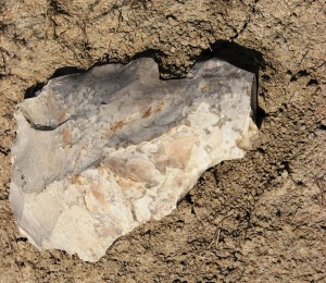
A stone tool retrieved by J. Barker at one of the site surveys.


When you take a closer look at the landscape you can find physical evidence proving that this region is unique. 

Evidence such as the scrapes and grooves on bedrock surfaces by glaciers, erratics and drumlins left behind when glaciers melted away.

Watersheds and their tributaries, originally a result of glacial melt water, continue to drain seasonal waters from the agricultural lands year round.  Present day Carolinian forests represent evidence of climatic changes in the great lakes region that supported a successful transition from a tundra-like environment over 10,000 years ago. 

Mega mammals such as mastodon once roamed the ecosystems of Southern Ontario only to disappear and be replaced by other mammal species.

Geologic formations date back over 80 million years ago where fossils of coral reefs can be found and chert formations were formed and found across Haldimand County.  People identified as Paleo-Indians used these same chert formations over 8,000 years ago to make stone tools as they crossed the landscape.

Regional studies were long-term and paid special attention to all aspects of a changing environment and landscape from one region compared to another.  Typically, a regional study combines different scientific disciplines (e.g., archaeology, geology, hydrology, and paleobotany) that can bring specialists to assist with the recovery of new information.   The results of a scientific study can produce new and unexpected insights into how the environment within a landscape once looked and how it was used by people.

Studies such as this create opportunities for community heritage to improve public awareness and education to understand how long term changes (e.g., climate, urbanization, and development) that can have an impact on a region.

What can a land owner expect when someone comes to their farm as part of a regional study? 

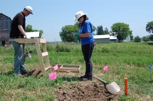
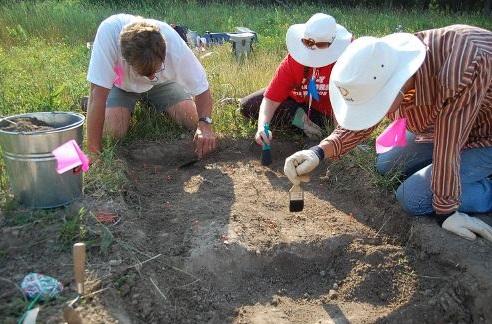
Permission is always asked to begin a study of the landscape on private property. For example, I always work independently, and if help is needed, permission is asked to bring an assistant along.  Once permission is given the study begins by walking over land repeatedly over a period of time and preferably free of crops.

Walking over open fields creates opportunities to examine the topography of the landscape, tributaries, plant and tree life, natural drainages, tree growth, and land elevations.  Observations of prehistoric camps or historical homesteads, and their refuse pits is recorded when found. 

Evidence of a camp or homesteads where people lived is called settlement patterns. 

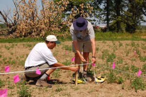
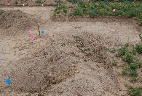
When settlement patterns are observed Geographic Positioning System coordinates are collected to record the exact location.  Even though archaeological excavations are sometimes necessary, they are restricted to a small area.  No excavation activity takes place unless permission is given by the landowner.

Even then, the landowner is first shown where an excavation is proposed on their property, and if crops are on the land, there is an offer of crop damage compensation based on current markets prices for wheat, soy, and corn.

A standard practice for a regional study is to recover and record the location of artifacts (e.g., prehistoric or historic) observed on the ground. These are recovered to gain new scientific insights regarding their origin, exact age, context, and association to surrounding landscapes.  This includes the recovery of samples from rock formations for geologic studies.

Since regional studies are focused on private lands, all information is kept confidential and private.  Information is not shared with the general public at any level, and there is absolutely no interference with farming practices whatsoever.  Its business as usual!  If landowners are curious to know what I am learning about the region from studying their farm land I am happy to share this information. For the Silo, Lorenz Bruechert/ Jarrod Barker. 

Lake Erie Finds Questioning Archaeological Establishment

“In my personal archaeological research I’ve been focused on the shores of Lake Erie (and a few inland sites) beach and general shoreline lithic retrievals— on the Canadian side of the lake—for many years.”

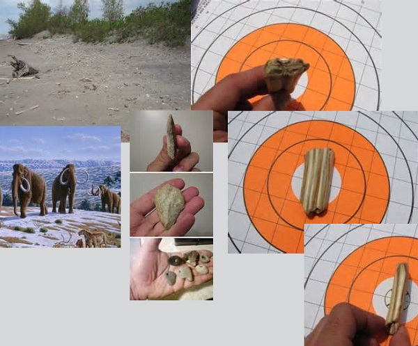
Top Left- one of the retrieval locations Top Right- one of the retrieved teeth sent to Dr. Walker Center- eg's of stone artifacts discovered in indirect association with some of the teeth
Top Left- one of the retrieval locations.
Top Right- one of the retrieved teeth sent to Dr. Walker.
Center- eg’s of stone artifacts discovered in indirect association with some of the teeth.

The surf and weather are odd bedfellows, on one hand revealing and on the other destroying, so it seemed obvious to me that I should keep eyes to the ground, sand, and wave line and to pick up what seemed to me to be artifacts.

Occasionally friable materials turn up such as large, disarticulated bones. Even a basket made from reeds turned up. And then there’s the teeth— found in several varied locations and in indirect association with what look to me like artifacts and pierced pebbles.

I’ve yet, however, to find any of this material in situ, i.e. still buried in its confining sediments.

Some of the teeth seem to have been ‘broken’ perpendicular to the long axes, some seem to have been burned and some show calcified deposits of calculus in the interproximal grooves (I worked in dentistry for several years so have a basic understanding of tooth morphology and deposit identification etc).

Some teeth were found inland quite a few miles away from Lake Erie. I later contacted Dr. Danny Walker, RPA, Wyoming Assistant State Archaeologist at the Comparative Osteology Museum and Zooarchaeology Laboratory. I emailed to him photos and descriptions of the teeth. He kindly offered to study several of the teeth. (Dr. Walker is a co-author of the research paper, Unraveling the sequence and structure of the protein osteocalcin from a 42 ka fossil horse, Geochimica et Cosmochimica Acta 2006;70(8):2034-44.)

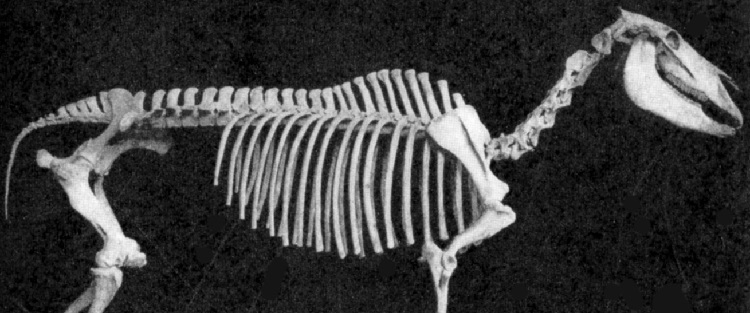
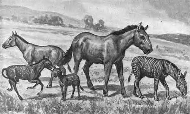
(Center) Equus Scotti- Pleistocene horse once native to North America.

Along with his graduate students, Dr. Walker identified the teeth that I had mailed to him as Equus scotti—Pleistocene ice-age horse. Now the story begins to resemble somewhat the X-files. The established archaeological community here in Ontario and the Royal Ontario Museum (I made all aware of the teeth, the lithics and the identification offered by Dr. Walker) disputed the finds, the identification and the lithics. The Royal Ontario Museum also told me that if I had the teeth dated and they showed as pre-contact, then they would offer this explanation— that the teeth were deposited on the Lake Erie shoreline after being brought aboard lake freighters from Europe; i.e. that they may have filled their ballast with gravels which could have included the teeth.

Putting aside the low probability of this possibility, as well as the fact that Equus scotti is a North American horse, the skeptics have failed to address the fact that some teeth were discovered inland—many miles away from Lake Erie. For the Silo, Jarrod Barker. 
Dry Cleaning Clothes May Be Harmful To Your Health


Twitter Facebook YouTube
Why you shouldn’t dry clean your “Dry Clean Only” clothes


Spilled BBQ sauce on your favourite shirt this weekend? Dry cleaning may be your go-to, but did you know PERC, a toxic chemical that’s been phased out in several jurisdictions around the world, is the most commonly used solvent in Canada? Read two common misconceptions about “Dry Clean Only” clothing labels and tips on how you can clean your linen, silks, and cottons the greener, non-toxic way.
 
the algae
monster
is back!
Lake Erie is expected to experience a significant algae bloom this summer. Read our latest blog to learn more about what causes the blooms and what this summer’s algae forecast could mean for the lake and the people who rely on it.
 

You can also show your support for the lake by taking our Lake Erie Pledge.

 
Show us how
Life’s a Beach
for a chance
to win
Our Blue Flag program is once again hosting the Life’s a Beach Photo Contest. This summer, share with us your best photos of your favourite Canadian beach. You could win $1,000 for new camera gear! Visit blueflag.ca/photocontest to learn more. The deadline to enter is Sept. 1.
 
POST TO FACEBOOK


Learn some tips on how you can clean your linen, silks, and cottons the greener, non-toxic way

POST TO TWITTER


Learn some #tipsandtricks for cleaning your linen, silks, and cottons the greener #toxicfree way

 
OTHER CAMPAIGNS WE’RE WORKING ON AT ENVIRONMENTAL DEFENCE


Alberta’s toxic tailings ponds keep growing and the cleanup costs keep rising. Giving feels good (over-stuffed closets don’t.) This year, throw an ECHOage birthday for us. Our work is possible thanks to caring people like you. Please make a charitable gift today in support of our environment!
READ MORE
LEARN HOW
DONATE TODAY


AT ENVIRONMENTAL DEFENCE WE CHALLENGE AND INSPIRE
CHANGE IN GOVERNMENT, BUSINESS AND PEOPLE TO ENSURE A
GREENER, HEALTHIER AND MORE PROSPEROUS LIFE FOR ALL.
  Twitter Facebook Youtube  

Prehistoric Trails Across Southern Ontario Farm Lands

Haldimand Norfolk Archaeology

For over 25 years archaeological efforts have been ongoing to delineate where potential prehistoric trails exist across the landscape of southern Ontario.   Trails were created and used by the earliest inhabitants of the region after glaciers disappeared some 15,000 years ago.  One of the roles for a trail system was to help keep people alive.

The challenge to identify the existence of these trails is that they existed approximately 10,000 years ago.  The primary region for this research has been Haldimand-Norfolk County.  In the past seven years the search for prehistoric trail systems in these two counties has become increasingly intensive as part of the Haldimand-Norfolk Archaeological Regional Project (HNARP) http://www.hnarp.ca/ .

The premise of the regional project is to better understand how early people lived and managed their lives on a  landscape once rich with animal, plant, and raw resources such as rock for making stone tools.

A critical activity that has assisted this regional project is permission to walk over farm lands from supportive agricultural land owners to help find these trails.  Access to farm lands assists archaeologists to identify where people lived in the region.  The land mass of the two counties combined covers approximately 2,000 square kilometers.

Historically, it was always possible to read information written down and recorded about trails in the region.  This would include place names and popularly used trails.  Even oral history in Haldimand County by senior land owners some 30 years ago mentioned trails used by people to walk across the landscape to neighbouring farms, villages, and the shores of Lake Erie.

Haldimand Norfolk Archaeology

To date, archaeologists have identified artifacts left behind by people still exist after 10,000 years of changes to the landscape.  One piece of evidence has been the type of stone used for making tools.  Throughout the world people searched out different types of rock for making stone tools.

In Haldimand County, chert formations created over tens of millions of years ago can be found.  These chert formations have different identifying markers such as colours and fossils that make chert distinct from others.  It is these identifying markers that help chert to be identified from its original source and help to develop new evidence to show where and when people lived and crossed the landscape.

It is hoped that finding and identifying the different colour cherts and fossils in the rock will help archaeologists piece together Haldimand-Norfolk County’s long forgotten past.   For the Silo, Lorenz Bruechert.

Record Number Of Clean Beach Blue Flags Now Flying

Pinterest
More Canadian beaches and
marinas awarded Blue Flags

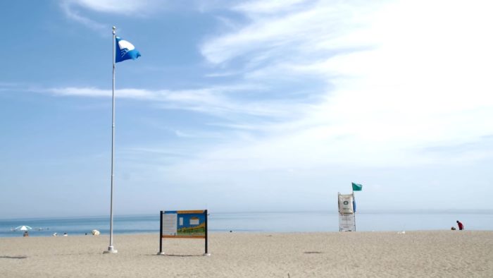
2018 is another record year for Canada’s waterfronts, 27 beaches and nine marinas have been awarded a coveted Blue Flag, including our very first coastal flag at beautiful Aboiteau Beach, NB. The Blue Flag is the internationally recognized symbol of environmental excellence for beaches and marinas. Read on to find the best waterside spots to spend your Victoria Day weekend.

Time for
the Government
to step up on
plastic waste
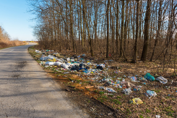
Only 11 per cent of Canada’s plastic waste is recycled.  Let that sink in for a minute.  This problem goes way beyond individual changes, we need the Federal Government to step up and take meaningful action before it’s too late. Sign the petition now to ask for a plastic free environment.
Banned chemicals found in products that babies chew, play and nap on A new study reveals that 86 per cent of tested products sold in Canada contain toxic chemicals, some of which are banned. Baby bibs, blankets and more were found to contain water and stain resistant chemicals linked to hormone disruption, and even cancer. Find out how you can take action.
Tell Canada that all high-carbon projects need an impact assessment What the frack?! The Canadian government is proposing to exempt fracking and in situ tar sands from the new federal environmental review process. We have until June 1st to fix this – send a letter now to tell the government that ALL high-carbon projects should get an impact assessment.

Chasing Ontario’s Tornados

Part One

I have seen many storms in my life. Most storms have caught me by surprise, so I had to learn very quickly to look further and understand that I am not capable of controlling the weather, to exercise the art of patience and to respect the fury of nature”

My name is Spencer Sills, and I am a storm chaser, some of you may remember a few years back reading about my good friend David Chapman and myself in this very newspaper and our journeys on the road to capture Nature’s fury through our lenses. Not much has changed since then, we are both still on the hunt for the elusive supercell and what fury may come with it.

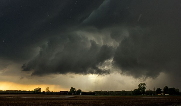
In 2014 my overall goal to capture a tornado in Ontario was once again successful, on July 7th I teamed with Scott Burlovich of Restless Skies photography and his chase partner Harry for the day and we set out to capture some pulse storms that were flaring up in the afternoon, most of these cells were just rain makers but on the way back to my home I had noticed a wall cloud that was lit up by the sun, we pulled off to the side of the road directly South of Norwich and briefly documented a EF0 tornado in a farmers field before it lifted causing no damage since it was in a dry field. This was my only tornado of the year, in a busy season. I did however get to document several gorgeous storm cells throughout the year, including several beautiful stacked shelf clouds and a great Wall cloud early in the season that brought golf ball sized hail to the area.

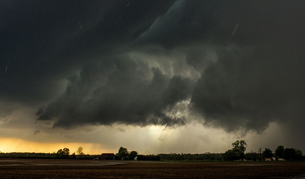
A Wall cloud in SW Ontario approaches my location as the RFD cuts around with hail starting to fall.

In 2015 I hope to achieve a few goals, one of which is to capture yet another tornado in this province, hopefully just like 2014 in an open field away from any properties. I also have set my sights on some goals with lightning and capturing it in a different perspective, I can’t go into much detail but it will be a stunning sight if I can achieve it. As far as how I believe the season will go, I do believe it will be a slow start, April and May will bring the return of storms, but I don’t expect anything too severe until June and July once the humidity and warmth really have a chance to build in. I do however once again stress to leave chasing to the pros, if you’re interested in storm spotting, please look into Canwarn, the more spotters in the province the quicker warnings can be issued thanks to verified ground reports.

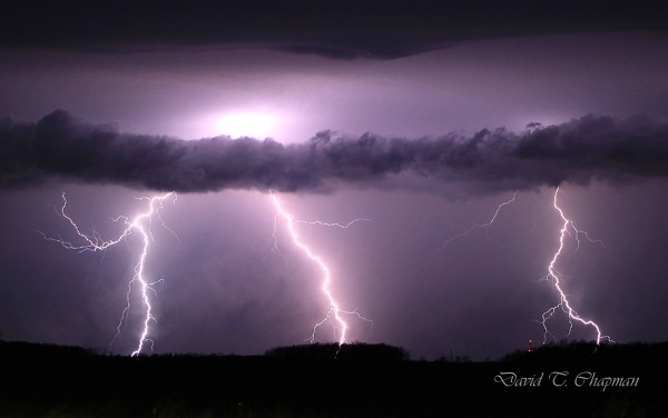
Lightning by Chapman

I will be working alongside another photographer and storm spotter this year, Scott Burlovich of Restless Skies, please feel free to check out his amazing work at restless-skies.com and give him a follow on twitter @restless_skies , you can also follow my journey for the year at Lightningfastphotography.com or on twitter @spencersills. I also want to send my best wishes to David Chapman for a great 2015, and as always look forward to meeting him in the field under the Meso, stay tuned for more updates and stay sky aware this summer!

Part Two

Another winter has come and gone, although perhaps slower than a lot of us would like. At least this means that the storm season is once again upon us in Ontario. As usual, Brian Chapman and I, a father and son chase team, will be back out on the roads looking for the best images of lightning and searching for Ontario’s tornadic super cells.

We will also be in close communication with our good friends and fellow chasers, Spencer Sills and Scott Burlovich, as we tend to share a lot of information about the biggest potential storms before we go chasing. You’ll notice when you look through their photography collections that they are a couple of the best for chasing down the biggest storms in our province.

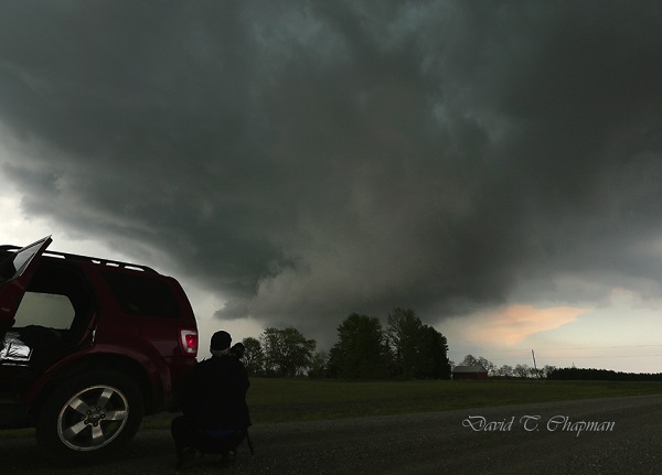
You might be curious on what we do when it comes to chasing the actual storm. Brian’s job is to be the driver. This is his first priority. Once we are parked and in a safe but photographic position for the storm, he is our main videographer. As for myself, I choose where I think the biggest storm will form from looking at weather models that meteorologists use as well as talking to fellow storm chasers in the area. I am also the main photographer. I do some video work and navigate us to the most photogenic side of the storm. This is usually right next to the most dangerous part of the storm but still in the safest position possible.

Rapidly Rotating wall-cloud photo being documented by Brian Chapman)

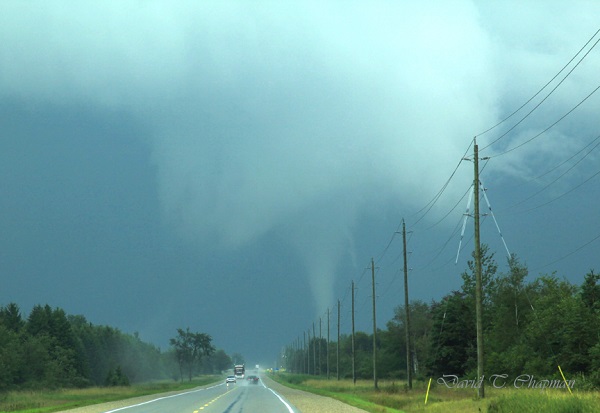
In the past 2 years, our team has seen and recorded a number of funnel clouds, 2 confirmed tornadoes and 4 waterspouts. One of the tornadoes was near Arthur, Ontario on August 7, 2013 and the landspout tornado was near Listowel, Ontario on May 14th 2014. The Arthur tornado was a really great one to document. It lasted for close to 15 minutes and we were able to see it from start to finish. The best part about it was the fact that  no one was injured and it caused very little damage. Those are the kinds of tornadoes we love to see because they allow you to enjoy the pure power and beauty that they possess but without injuries or major destruction.

Tornado by Chapman

Another thing that was interesting with the tornado that hit near Arthur was the fact that it tried to form a second tornado at the same time the first one was on the ground. If that funnel had reached the ground, it would have been called a satellite tornado. They are typically smaller and weaker but not always. In Pilger, Nebraska in 2014, two EF-4’s were on the ground at the same time. Sadly they hit a town, killing 5 people and injuring 19. Those are the days I dread as a chaser and hope I never see first hand. As for the second funnel near Arthur, it didn’t quite have the energy to make it the rest of the way to the ground. This probably wasn’t such a bad thing with so many people focusing on the main, larger tornado just to its north.

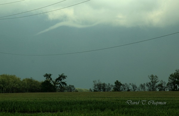
A Funnel Cloud
A Funnel Cloud

Fortunately, a lot of Ontario’s tornadoes hit open areas that cause little to no damage. There have been some exceptions, as the tornadoes that hit both Durham, Ontario on August 20, 2009 and Goderich on August 21, 2011 showed, both killing one person in each of them. That is why many storm chasers as well as dedicated weather enthusiasts in our province have a direct line to Environment Canada that allows us to contact them when we see threatening weather approaching the area we are in. It can help Environment Canada confirm what they are seeing on radar so that they can issue the proper watches and warnings accordingly. Refer to Spencer Sills’ Part One above for more details on how you can become a spotter. Lightning will also be a big focus for our team this year. We continue to work to get lightning photos as close as possible in order to capture the positive leaders that come up to meet the main negative current coming down from the cloud. The leaders can come from the ground, hydro poles, houses and even people.

Although this may be risky and dangerous, we have worked out ways to minimize the risk to us. We stay in the car when lightning is close with the windows up. We also won’t park under a tree, not so much from the fear of a direct lightning strike but in case lightning hits and splits the tree causing it to fall on the vehicle. I remember seeing one like that when I was young and it has had an everlasting impression on me. One of the first big wind storms I chased along Lake Erie on November 1, 2013 knocked down a tree onto a woman‘s car and unfortunately she was in it and was killed. So debris is always a concern and something to be very aware of when it comes to storm chasing.

You can follow our storm chasing throughout the year on our social media pages. https://twitter.com/DTChapmanPics https://www.facebook.com/pages/David-T-Chapman/173134962767601?fref=ts https://twitter.com/WeatherHunters

Toby Barrett
~CLICK ME~


The Big Year Is A Fun Comedy For Bird Enthusiasts

I first took notice of this film because of where I live- which is not that far away from Long Point, Ontario, a mecca for birdwatchers. I find that it’s a more immersive experience to watch a movie that is connected thematically in some way to the sorts of activities that the area I live in has to offer. This reinforces the suspension of disbelief while watching and serves to supercharge the imagination.  If you live in a seaside community and you’ve ever watched Jaws followed by a bit of swimming you know exactly what I mean.

Back to the birds 

The main story arc of The Big Year goes a little like this:  A ready-to-retire-but-not-quite-sure-its-the-right-time-to-retire businessman and a mid-thirties-divorced-unemployed-savant (he can identify any bird just by hearing a few notes of its birdsong) aim for beating the current single year record of bird sightings. In the parlance of the ‘birding’ community, this is known as doing a ‘big year’. The current record holder, played by Owen Wilson, is the rock-star of the ‘birding’ community and is completely obsessed with stopping anyone else from beating his record- even if this means missing the birth of his child and ruining his second marriage.

Highly competitive obsession

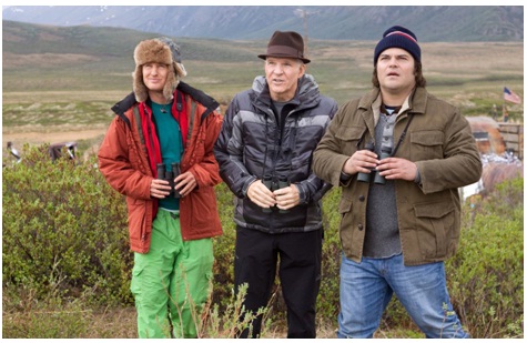
Jack Black, Steve Martin and Owen Wilson in the The Big Year.

I always believed that birding was a slowly paced albeit serious hobby but this movie turns the notion on its head. The story develops and moves quickly. The characters are highly  competitive and race against each other as the suspense and intensity builds.

The Big Year is satisfying, clever and funny . If you are a birder there is a good chance that you will love this movie (especially if you can relate to the obsessive compulsive behavior of the main characters) but then again you might end up blaming this movie- you might decide on doing a big year and to hell with anything and anyone in your path. For the Silo, Doug McKenzie.

Jack Black’s character feeling bad (but not that bad) about Steve Martin’s character picking up the dinner tab.

Supplemental- The Big Year:A Tale of Man,Nature and Fowl Obsession by Mark Obmascik.  http://www.pbs.org/newshour/bb/entertainment/jan-june04/bird_04-12.html

Lake Erie Fisheries At Risk Or Set For Bolstering From Invading Fish


No perch or pickerel in Lake Erie’s fisheries future? The tasty fish our Great Lakes are known for, and all other sport fish, could be decimated if the insidious Asian carp migrate from the Mississippi watershed.

Combined, the four Asian carp species could decimate the Great Lakes fishery by out competing our native fish.

Plankton, which is the base of the Great Lakes food chain, is consumed by silver and bighead carp. Grass carp prefer plants while black carp eat mollusks. Asian carp can consume up to 20 per cent of their weight every day.

Since escaping impounds near the mouth of the Mississippi River, the carp have spread north and are very near the Great Lakes in the Chicago Sanitary and Ship Canal. So far, everything from electric barriers to water-propulsion jets to noise cannons have been considered to keep them at bay.

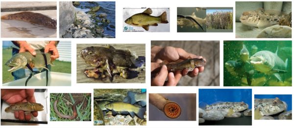
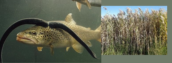
BING image search results for “Ontario Invasive Fish Species”.

But, the systems aren’t perfect. A silver carp was caught on June 22, just nine miles from Lake Michigan. Two weeks of intensive monitoring did not find any other carp. The captured fish has been sent for laboratory analysis to search for more clues on how it got there.

While some fear this is the beginning of the end, it should be noted that a bighead carp was also found in the area in 2010. The protocol for stepped-up monitoring wasn’t in place then, but no Asian carp have been found in the area in the ensuing seven years.


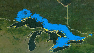
Most of the media attention rightfully is focused on the Chicago Sanitary and Ship Canal (zoom and scroll on the map above)  as a route for the invasion, but it is not the only possible route. Silver carp have been found in the Ohio River and that state’s Little and Great Miami Rivers – all pathways to Lake Erie. Barriers have improved in Indiana’s Eagle Marsh, where, during flooding, there is a possibility carp could move from the Mississippi watershed to Lake Erie.

Although science and technology continue the search for solutions to the Asian carp threat, politics can get in the way. The Great Lakes states, with the exception of Illinois and Indiana, were in favor of blocking the Chicago Sanitary and Ship Canal. Perhaps the last president hailing from Chicago was a factor in this not happening.

While on holidays in Louisiana, I testified at Army Corps of Engineers hearings for their Great Lakes and Mississippi River Interbasin Study. I support chemical, electrical, vibration and other methods used to deter invasives moving up the Chicago canal.

The U.S. administration has stalled the release of their report, although two weeks ago, the U.S. Senate Appropriations Committee approved a bill that would force its release.  The bill had support from both sides of the House.

Similarly, there has been bi-partisan support to block a move in the presidential budget that would slash the Great Lakes Restoration Initiative funding from $300 million to zero. A portion of that funding goes to Asian carp programs.

On the home front, I have pushed for legislation that Asian carp brought into Ontario for food must first be eviscerated.

Ontario has passed the Invasive Species Act, becoming the first province with legislation dedicated to addressing the threat. Asian carp are included in this law.

Much of the attention and expenditure on Asian carp has been south of the border. In my view, more could be done in Ontario. For the Silo, MPP Toby Barrett.

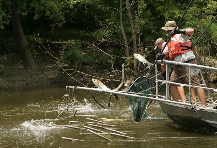
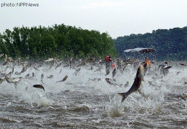
Featured image- Electrofishing for the invasive Asian carp (Photo By U.S. Fish and Wildlife Service [Public domain]

Supplemental- Is Asian Carp ‘invasion’ actually a secret ‘stocking initiative’ for bolstering commercial fishing?  Published on 13 Aug 2013 Asian Carp Processing Plant- Kentucky -Two Rivers Fisheries in Wickliffe, KY is taking a run at the Asian Carp market. With an abundance of Bighead and Silver carp in nearby waterways, the fish market is set to process and sell these fish for consumption. Commercial fishermen have often said if you pay us for the invasive carp we will catch them and that is exactly what is happening in Western Kentucky.

Barrett: Ontario Invasive Species Act Still Needs More Work

When sea lamprey became entrenched in the Great Lakes, the impact on native fish was tremendous. Decades later, we are still battling lamprey, but Asian carp are waiting at the door with ramifications that will make lamprey look tame.

Fallout on ecosystems and native species is often severe, and sometimes irreversible. The damage Asian carp could do to our Great Lakes is unimaginable and the phragmites invasion is choking out wetlands across the province. Damage from invasive species is not just ecological, but also financial with estimates of $7.5 billion annually on forestry and farming.

When passed, the province’s new Invasive Species Act will make Ontario the first province to have such a law. Basically, the bill lays out how to help prevent invasive species, how to detect and respond rapidly to the presence of new invaders, and effectively manage those already established. The concept is admirable, but I do have a few concerns.

The bill has wide-ranging support from various stakeholders, but it is reactionary when in many cases a more proactive approach would be appropriate.

To start, the identification of invasive species will be done through a so-called black list. It requires harm from a species before it will be regulated. However this is reactive rather than preventative. To explain further, the approach to sea lamprey is reactive, whereas the present approach to Asian carp is preventative. It’s easier and less costly to deal with an invasive species before it’s established.

An approach that is frequently recommended, but not used in this bill, is the pathways approach. Using this approach, the regulation of invasive species is based on the risk of invasion via certain pathways so it can be regulated and the risks mitigated. One example is requiring the gutting of all Asian carp imported into Canada for food to make sure they are dead.

The bill does not outline a science-based approach to risk assessment and decision making. My concern is red tape to identify invasive species will hamper prevention efforts.

The act downloads the responsibility of implementation to landowners, but leaves little incentive for landowners to act. As a property owner, I have concerns the bill will be punitive and unfair.

The bill creates two classes of invasives – significant threat and moderate threat. Although there are tools to deal with moderate-threat invasives in provincial parks, there are no tools or authority for private landowners. I have seen this in my own battle against phragmites on our farm and the limited tool kit permissable.

Another concern is the act would create a heavy-handed regulatory scheme that will punish innocent persons who have the misfortune of having an invasive species on their land and download costs of dealing with it to the owner. I am also opposed to the warrantless entry provision for authorities to search property and buildings.

The penalties set out in the act are higher for corporations than individuals. While this concept seems sound, the government failed to take into account the fact many businesses and family farms are incorporated.

I have faith in the science personnel within the Ministry of Natural Resources and Forestry who provided the basis for the act. But I also believe there is a wealth of knowledge amongst anglers, hunters, naturalists, farmers and commercial fishermen and their associations that can be incorporated with more public consultation. Toby Barrett, MPP

SupplementalGreat Lakes Commerical Fisheries Michigan Fish Producers Conference

Bill 167 Ontario’s Invasive Species Act 2014

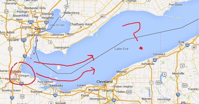
Toxic Algae Blooms in Lake Erie Cause Water Emergencies

Toxic algae. The Silo @thesiloteam · 1m
Lake Erie toxic algae bloom causes water emergency in Toledo, OH -citizens scramble for bottled water http://patch.com/michigan/novi/lake-erie-toxins-leave-southeast-michigan-ohio-residents-without-water#.U94tq7fD_IU#Silo #Earth

It doesn't take a lot of imagination of smarts to understand that toxins can travel in water. Ohio and Southwestern Michigan which have notified the public of the water crisis are dangerously close to other Lake Erie shoreline communities. Some communities such as Norfolk County already have beaches posted with bacteria warnings and notices that the water is NOT tested by local health officials.
It doesn’t take a lot of imagination of smarts to understand that toxins can travel in water. Ohio and Southwestern Michigan which have notified the public of the water crisis are dangerously close to other Lake Erie shoreline communities. Some communities such as Norfolk County already have beaches posted with bacteria warnings and notices that the water is NOT tested by local health officials.


T
he Silo @thesiloteam · now
What are implications for #Oxford #NorfolkCounty #Haldimand County communities water supply? Bacteria/ Algae signs already posted on beaches
 

Asian Silver Carp Set To Invade Great Lakes

The Great Lakes are one of the world’s most important natural resources – holding one fifth of the world’s fresh surface water, home to more than 150 species of fish, and vital to the economy of Ontario and neighbouring U.S. states. But several kilometres from Lake Michigan lurks a threat that could change the Great Lakes forever. The fish known as Asian carp could wipe out native fish species, devastate sport and commercial fisheries, and cause far-reaching changes to the Great Lakes ecosystem.

If you need proof of the danger to the Great Lakes, take a look at the Mississippi River Basin. After escaping from aquaculture ponds in the southern U.S. in the 1970s and 80s, Asian carp have spread steadily northward. In parts of the Mississippi and other rivers, invasive, voracious Asian carp have crowded out native fish and make up as much as 90 per cent of all fish by weight. Only electric barriers in a canal near Chicago are currently keeping the fish out of Lake Michigan.

The need for a coordinated plan to fight Asian carp led the Ontario Ministry of Natural Resources, with support from the Department of Fisheries and Oceans Canada, to host a “table-top exercise” in March. The exercise simulated an incident where Asian carp get into Ontario waters. The aim was to test if the agencies involved are ready to respond quickly and effectively.

“Preventing Asian carp from spreading into the Great Lakes is the most cost-effective control measure we’ll ever have,” says Ontario Minister of Natural Resources Linda Jeffrey. “This exercise was about making sure all the agencies involved work together, and identifying areas where we’re vulnerable.”

For the March exercise, participants rehearsed how they would respond IF an accident on a bridge over the Thames River in southwestern Ontario caused a truckload of live Asian carp to be dumped in and near the river. It was a timely choice – only a week earlier a fish importer had been fined $50,000 for trying to truck 1,800 kilograms of live Asian carp across the Windsor/ Detroit border to sell in the Greater Toronto Area. It’s illegal to possess live Asian carp in Ontario.

The term “Asian carp” includes four species – bighead, silver, grass and black carp. The bighead and silver carp currently pose the biggest threat. They weigh up to 45 kilograms and can grow to more than a metre long. As filter feeders that can eat 20 per cent of their body weight a day in plankton, they’re able to grow and multiply faster than native species. In some areas in the U.S. carp populations are doubling every year.

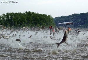
Silver carp are also a hazard to people on the water. When disturbed by boat motors, the fish jump as much as two metres out of the water. Boaters and water skiers on the Illinois River have already been hit and injured.

Canadian and U.S. experts agree that Asian carp would thrive in the Great Lakes, and that quick action is the only way to prevent Asian carp from spreading if they are found in the Great Lakes Basin.

During the table-top exercise, local MNR staff described how they would place nets upstream and downstream to catch and identify fish in the river, test the fish to find out if they could reproduce, and confirm if the river habitat was suitable for Asian carp. The agencies involved also had to decide if any local species at risk might be harmed by the control measures, and keep governments, partners, the public and the media informed.

“Ontario’s recreational fishery contributes $500 million to the province’s economy each year, our commercial fishery is worth up to $215 million a year, and the Great Lakes ecosystem is priceless,” says Minister Jeffrey. “With so much at stake, we have to be prepared.” For the Silo, Lacey Williamson. 

Ontario Beach Zoomorph Profiled In Mexico City University Of Art Publication

Artist Jarrod Barker, was recently invited to take part in MUCA-Roma’s Ala Afuera project. Based in the Roma district of Mexico City, MUCA is a University Museum of science and art. What made this project doubly exciting was the opportunity to show case a part of Barker’s home internationally.

The curators asked for a submission of 3 images and accompanying explanatory write-ups that “from your perspective, show a form of relationship between humans and the rest of nature.” This topic aka- Umwelt is not foreign to Barker who installed an exhibition of that name in 2010 at the Norfolk (nee Lynnwood) Arts Center in Simcoe,Ontario.


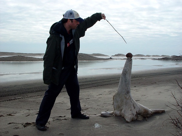
Long Point Seal Tamer Concept- J. Barker
Location: Long Point, Norfolk County, Ontario, Canada
Long Point is a world biosphere. I know this because the United Nations has told me so. But for several months of the year Long Point is transformed. Under certain winter conditions, Long Point looks less like a marshy, swampy bird watchers paradise and more like an arctic shore. At least on the South West side. When I visit Long Point during these times, I react to the environmental changes. I see things differently. I feel things differently. A sun bleached tree stump becomes a seal. A marsh reed becomes a baton. A flint pebble becomes a ball. Natural transformation through the changes of the seasons is a holistic experience.


After the selection process, if successful- one of the artist submitted images and write-ups was selected for transformation into a postcard and incorporated with the other artist submissions. The goal was for the Ala Afuera team to mail out the postcards to other international Museums of art and science and Contemporary Art institutions as a connective gesture to highlight MUCA and the work of the artists involved in this project and to bring awareness to our human/nature relationships.


“The objective of the project Allá Afuera (Out There) is to gather a mosaic of images that represent
ways of understanding the relationship we humans have with the rest of nature. From bucolic or
passionate points of view to other more threatening myths and taboos, amazement, fear, the absurd,
and maybe even indifference. We do not intend to cover all possibilities, but through images as a direct
reading form, show that there are multiple ways of looking at this Bond.

Three times a year we will present a collection of postcards, with 18 images each, gathered in a
biombo format. After two years we will complete the edition of six collections, with a total of 108 ways
of understanding, 108 points of view, and 108 forms of defining our relationship with what is out there. “

Ala Afuera which translated mean’s “Out there” began mailing out the works a few weeks ago.  For the Silo, Stephanie Bordega. 

For more information and to request postcards please contact-
Allá Afuera (Out there) project Gonzalo Ortega and Jeronimo Hagerman
MUCA ROMA MUSEUM (University museum of science and art, Roma district, Mexico City)
allaafueramucaroma@gmail.com

Click me!

Five Summer Road Trips

Ahhh, the Summer road trip. Time for cooler packing, map folding (or GPS charging) and a car tune up. Does anyone drive a station wagon anymore?

Within the past 12 years I have traveled to and written about over two hundred travel destinations, many within a few hours drive of Niagara. That said, I ‘m often asked what are my favorites. Well, I’ve finally taken the time to think back and jot them down. Before I begin, I should say that I have learned to love the journey just as much as the destination. My primary route to get to a place, when possible, is usually the back way, not the highway, preferably with lots of twists and spectacular scenery. I don’t sweat about getting lost; I’ve found some of my most interesting adventures that way. Another thing that makes for a pleasant journey is to travel on the arm of someone you love. The following are the Coles Notes version of some of my favorite trips.

A yummy car. Memories of old old spice (you know the white bottle?), adidas shorts, sweatbands, the Cars on 8-track and road trips….lots of road trips. #thepastwasablast

Port Rowan, Ontario (138 kilometers)
When you discover this lovely community that hugs the northern shoreline of Lake Erie you’ll be charmed. Nothing shouts. When we walked their tiny main street, which consisted of restored century old stores, we could feel the past. At one end was one of the prettiest habors in Ontario. The whole world slows down when we walked the mature tree-lined side streets where we found historic turn-of-the-century homes that called out to be photographed. If you decide to stay over there are plenty of cozy Bed and Breakfast places to choose from.
Stratford, Ontario (159 kilometers from Thorold- the center of Niagara)
This is a jewel of a city located on the Avon River surrounded by a plethora of affordable eateries, restored Victorian homes on streets lined with majestic mature trees. We fell in love with their walkable downtown filled with plenty of unique shops and a majestic 12–sided red brick building with Queen Anne features built in 1898-99 that serves as their City Hall. The place was buzzing with life. Stratford Tourism offers two free escorted walking tours, a Downtown Historic Tour and a River Walk Heritage Tour.
And of course, there’s the Stratford Festival which serves up top-notch live theater. This season’s calendar opened in mid-April with the musical 42nd St.
This is the home of teen idol Justin Beiber and your teenagers can get a free map from the tourist folks outlining his favorrite places.
www.visitstratford.ca or 1-800-561-7926

The author George Bailey: “I’m often asked what are my favourite [travel destinations] withina few hours drive of Niagara. Well, I’ve finally taken the time to think back and jot them down.”
Elora, Ontario (126 kilometers)
This lovely 177 year-old village is a place that will grow on you the minute you arrive. It’s located on the Grand River where the Elora Gorge begins. Check out the magnificent waterfall and the high rock known as The Tooth of Time, behind the Elora Mill Inn.
We continued to explore the shops, boutiques and restaurant found on Mill and Metcalfe Streets. One unique shop is The Village Olive Grove. It’s one of the few stores in Canada that sells (and allows you to sample) exceptional olive oils and vinegars. One site not to miss is the reflection in the Grand River of the back of the downtown stores.
www.elorafergus.travel or 519-846-0971.

[If you are planning a long road trip with a dash of night driving- remember to fully rest up and stop driving when you are feeling tired CP]

We have to agree with luckysod04 on this…but check out TOSH.0 parallel parking a Mini Cooper LOL

Lindsay, Ontario (229 kilometers)Lindsay is the gateway to the Kawartha Lakes tourist region. It’s pretty as a picture. One of the main features is Kent Street, the town’s wide main street. It looks like a Norman Rockwell painting. The first to fall under the lens of my camera was the renovated 1893 Academy Theatre at one end of town. Lindsay’s renovated City Hall and Firehall also weren’t too shabby to photograph.
Their Saturday morning Farmer’s Market proved to be a real farmer’s market. It was filled with real farmers who sold produce they have grown on family owned farms for centuries. www.explorekawarthalakes.com or 1-866-397-6673

Aylmer, Ontario (187 kilometers)
Like many of my trips, you have to look beyond what’s found in the tourism publications to experience a community. It’s more than the location of the Ontario Police College. It has a large farming community. Take a ride along the back roads where you will share the road with an industrious Amish community who travel by horse and buggy and operate farms without most modern-day luxuries. Aylmer’s indoor/outdoor Farmer’s Market held on a Tuesday is top-notch. Check out the nearby quaint village of Sparta where you’ll come upon examples of restored period homes dating back to 1825.Don’t miss visiting the Winter Wheat attraction set in a five-acre forest of towering pines.
http://www.aylmer.ca/. or 1-519-773-3164.

for the Silo by George Bailey  wonderful.life@sympatico.ca

Click to view on I-tunes

Southern Ontario Four Hundred Billion Years Ago

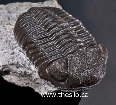
Phacops rana roughly translates to “frog eyes”

Picture yourself swimming in the shallows of Lake Erie over 400 million years ago. You might come up with all kinds of ideas of what primitive life was like. Some might imagine archaic sharks and bony, lobe-finned fish, but I bet very few would conjure up Phacops Rana.

Great Eyesight

This specialized trilobite can be found throughout Norfolk County in shale deposits and occasionally on our beaches, embedded in fossilized chunks of coral. One member of The Silo team discovered a beautiful specimen preserved this way, but it takes a keen eye to recognize them. That’s because the only way to find them is to identify the one feature of Phacops Rana that is its namesake: phacopid eyes. You see, this trilobite had two large eyes that were full of round, swiveling lenses, giving the creature an advantage when it came to escaping predators.