Tag Archives: HNARP

Fossil Shows Canada Had 400 Day Long Year

Haldimand and Norfolk Counties in Ontario, Canada have become an attractive area to explore for marine fossils.

The Great Lakes Basin, once inundated by a vast ancient, shallow sea that covered much of central North America, is today revealing an abundance of fossil corals, invertebrates, and marine organisms found within many limestone formations uncovered by glaciers and erosion.

Haldimand and Norfolk County have especially become an attractive area to explore for fossils of marine organisms by both scientists and amateur fossil collectors who can travel to local locations such as Rock Point Provincial Park near Dunnville, Ontario.

However, these fossils represent more than just evidence of unique life forms that once numbered in the tens of thousands of species co-existing in a marine ecosystem. They are scientific evidence of marine ecosystems in ecological transition, shifting continents, changing climates, and a record of our planets’ every day rotation around the sun.

Many fossil corals found in Haldimand and Norfolk County date around 410 to 360 million years ago. It is a time geologically known as the “Devonian Period”, the “Devonian Reef” or the “Age of Fishes”. During this period, fishes of many different species became abundant in the fossil record. A partly submerged North America, or as yet to be formed Great Lakes Basin, was colliding with Europe close to the equator. Reef building environments began to develop and produce some of the largest reef complexes in the world.

The reef complexes were in large areas of shallow equatorial seas that existed between the continents.

Evidence of a saltwater sea supporting a vast coral reef system once covering southern Ontario over 400 million years ago in the form of fossilized coral deposits support the theory that a coral reef system existed for a very long time. It was in the basins of these former shallow seas that great quantities of rock salt, gypsum, and other types of minerals precipitated, and today, mining industries dig well below the lowest depths of Lake Erie to recover these minerals.
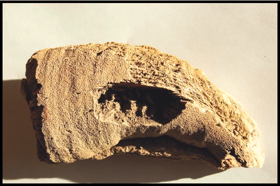
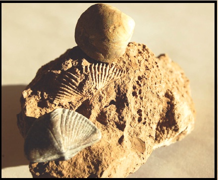
The “Heliophylum halli” is a fossil particular to the Great Lakes region and studies of its growth rings revealed 400 days in one Earth year when this coral was alive.

Exposure of reef basins varies and depends on how glaciers or water erosion has pushed or washed soil off bedrock. Under these conditions, a geologist’s field magnifying glass can help find very small fossils such as radiolarians and diatoms. Otherwise, larger fossils such as different varieties of bivalves (clams), trilobites, and even large fragments of fossilized coral are exposed. In some case, there are discoveries of fossilized marine organisms that are both rare and some times difficult to identify.

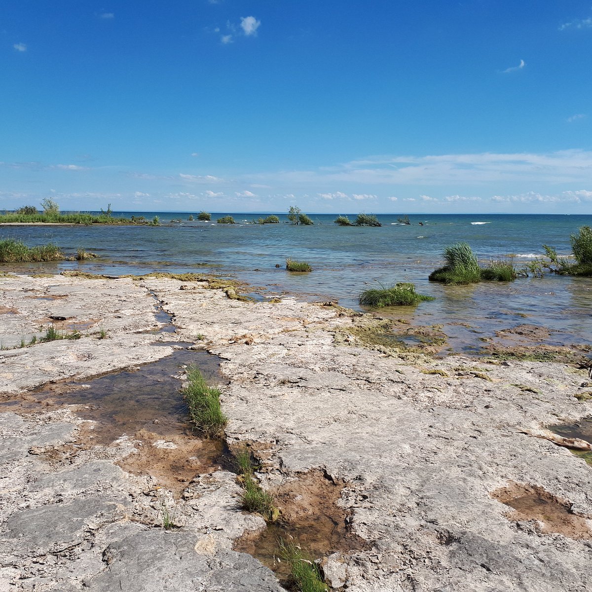
The fossilized remains of a Devonian Reef. Rock Point Provincial Park, Ontario.ROCK POINT PROVINCIAL PARK (Dunnville) - 2022 What to Know BEFORE You Go

What ended these reef complexes and created one of the greatest mass extinction events of earth’s biota was a combination of events that took place over a period of 25 million years.

Since species rely on a warm water marine ecosystem for their survival it would seem that a slow and gradual continental shift north from the equator would over time impact a large variety of marine species, including those supported by coral reefs. Therefore, events such as shifting continents, lowering of sea levels, climatic changes influencing land and sea ecologies, and/or possibly a glaciation had significant roles in the extinction of earth’s biodiversity.

Devonian Period - Geology Page
The large deposits of fossil corals and invertebrates found in Norfolk and Haldimand County has been of great interest to scientists and fossil collectors for many decades. However, fossil collecting took on a new importance in the last 50-60 years when it was determined there was a connection between growth rings of coral skeletons with the number of days in a year.

Scientists studying samples of coral skeletons from contemporary coral reef systems discovered growth rings on the outer surface of coral skeletons.

By studying a large sample of coral skeletons and determining how many growth rings represented a year’s growth of calcium carbonate, scientists were able to calculate an average of 360 rings per year. Thereby, approximately one growth ring represented one day’s growth for each day of the year. Taking this new information, scientists began collecting large numbers of exceptionally well-preserved coral fossils belonging to the Late Devonian Period. One particular species, found in the Great Lakes region, called a “Heliophylum halli” (see above) exhibited many growth rings developing in one year during this period. The result surprised even scientists.

Fossil coral showed there were approximately 400 growth rings per year 370 million years ago. Therefore, there were about 400 days in a year in the Devonian Period. Astronomers who have calculated that our earth’s rotation has been slowing at a rate of about 2 seconds every 100,000 years have since supported the new information.
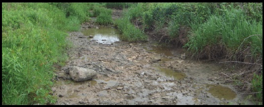
Exposures of ancient reef basins can be discovered in dried up stream beds and even under farmers fields.

Despite Haldimand and Norfolk County being a small example of a region once holding a thriving coral reef system, existing over 400 million years ago, the number of fossils of different species exposed is vast. Fossil corals, invertebrates, and species of marine organisms exist in many different shapes, sizes, and can be very fragile. Therefore, whether you are a scientist or amateur fossil collector, the next time you take a walk across the landscape to explore and search for fossils be sure to take along a fossil guide. You never know what new fossil discoveries you might make just walking across the countryside for an afternoon. For the Silo, Lorenz Bruechert.

Prehistoric Trails Across Southern Ontario Farm Lands

Haldimand Norfolk Archaeology

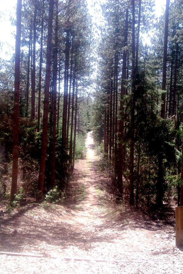
For over 25 years archaeological efforts have been ongoing to delineate where potential prehistoric trails exist across the landscape of southern Ontario.   Trails were created and used by the earliest inhabitants of the region after glaciers disappeared some 15,000 years ago.  One of the roles for a trail system was to help keep people alive.

The challenge to identify the existence of these trails is that they existed approximately 10,000 years ago.  The primary region for this research has been Haldimand-Norfolk County.  In the past seven years the search for prehistoric trail systems in these two counties has become increasingly intensive as part of the Haldimand-Norfolk Archaeological Regional Project (HNARP) http://www.hnarp.ca/ .

The premise of the regional project is to better understand how early people lived and managed their lives on a  landscape once rich with animal, plant, and raw resources such as rock for making stone tools.

A critical activity that has assisted this regional project is permission to walk over farm lands from supportive agricultural land owners to help find these trails.  Access to farm lands assists archaeologists to identify where people lived in the region.  The land mass of the two counties combined covers approximately 2,000 square kilometers.

Historically, it was always possible to read information written down and recorded about trails in the region.  This would include place names and popularly used trails.  Even oral history in Haldimand County by senior land owners some 30 years ago mentioned trails used by people to walk across the landscape to neighbouring farms, villages, and the shores of Lake Erie.

Haldimand Norfolk Archaeology

To date, archaeologists have identified artifacts left behind by people still exist after 10,000 years of changes to the landscape.  One piece of evidence has been the type of stone used for making tools.  Throughout the world people searched out different types of rock for making stone tools.

In Haldimand County, chert formations created over tens of millions of years ago can be found.  These chert formations have different identifying markers such as colours and fossils that make chert distinct from others.  It is these identifying markers that help chert to be identified from its original source and help to develop new evidence to show where and when people lived and crossed the landscape.

It is hoped that finding and identifying the different colour cherts and fossils in the rock will help archaeologists piece together Haldimand-Norfolk County’s long forgotten past.   For the Silo, Lorenz Bruechert.
The Fuss About Archaeology Conducted On Ontario Farmlands

Farmland development throughout wind-powered Ontario has resulted in the hiring of many consulting archaeologists by developers of solar panels and wind turbine farms and the public continues to wonder why so much attention is given to archaeological sites several thousand years old that hold little or no cultural value to the people who live there today. One reason is simple to explain: developers closely follow the laws of the Ontario Heritage Act, which promotes the protection, and conservation of heritage sites before and after European Contact and therefore are bound to archaeology. The Heritage Act came into force in 1975 as a way to protect archaeological sites. Even architectural structures built over a century ago come under the protection of the Heritage act if deemed of historical significance.

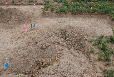
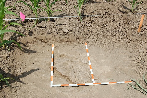
This photo shows a ‘feature’- where stone flakes were recovered from a flintknapping moment about 7,000 years ago.

But other than the legal issues, what is all the fuss about these archaeological sites in Ontario rural municipalities? Well, a lot has to do with how little the public knows about the earliest people who began to inhabit the Great Lakes region over 10,000 years ago. Increased development has resulted in many archaeological sites being uncovered, which helps to answer questions such as: who were these early people? How did they survive? [Especially during a time of mammoths and glaciers CP] Where did they come from? How were they impacted by climatic changes? How long did they live on the landscape before being replaced by other groups of people? Which leads to another, penultimate question: How can these questions be answered?

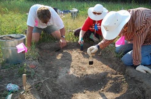
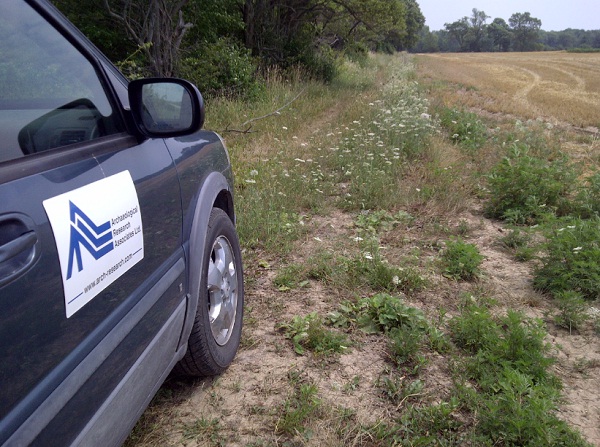
Complying with the Heritage Act- solar and wind power developers are hiring more and more consultant archaeology firms to conduct studies of Ontario farmland. This picture taken on July 17, 2012 at an area East of Nanticoke, Ontario. photo: The Silo

Here is one way. Archaeologists working on a site discovered a location where an ancient person was breaking stone into smaller pieces for making stones tools. Archaeologists found a location below the ground surface where pieces of stone fell and remained for over 7,000 years. One of the first questions archaeologists tried to answer is was that person standing or sitting down at that particular location when they dropped the pieces of stone.

The best way to answer that question was to do “experimental archaeology”. In this case, stone tools left in a forest are observed to determine how natural processes move and cover artifacts over time. Some stone tools are ‘dropped’ or left while standing and others while sitting down on a log or other structure. The difference in posture and stance and the difference in the height of the drop affect the way the pieces of stone fall, land and how they orient themselves on the ground.

Click to view on I-tunes

This affects the way that they are weathered, covered and deposited. After a long period of experimenting and observation, it was determined that a person likely sat on a log while making their stone tools. The broken flakes of stone, covered and protected by forest debris, resulted in a well-preserved location where someone once sat down to made stone tools.
So the next time you come across a scatter of broken stone try to imagine who sat there as they made their stone tools and what the land once looked like long ago. For the Silo, Lorenz Bruechert. /Jarrod Barker.
 

Australian Archaeologist In Ontario For Practices Exchange

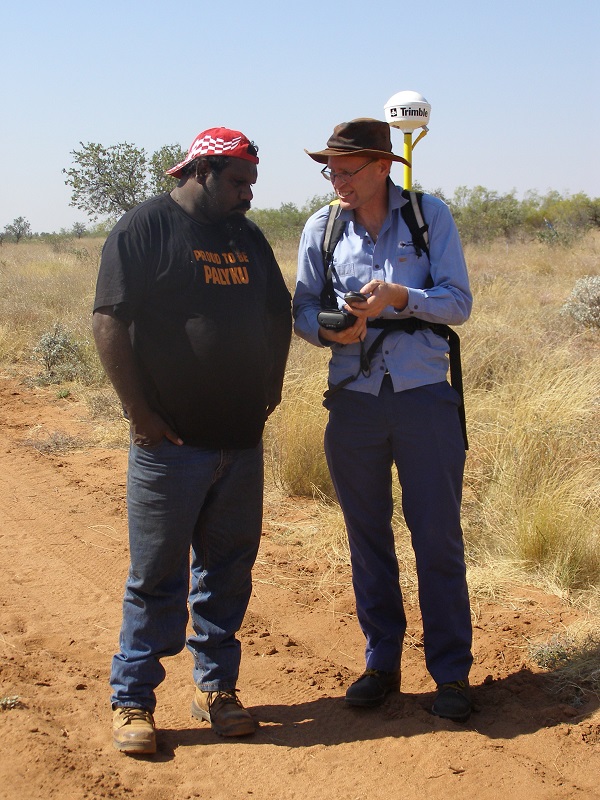
Lindsey Yulline & Phil discussing DGPS

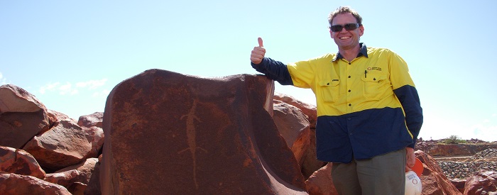
Phil Czerwinski of Perth, Australia and director of “Heritage Western Australia” an archaeological consultant company focusing on the survey of indigenous rock art, archaeological, and ethnographic sites in Western Australia came to learn about archaeology in southern Ontario. Phil arrived in Haldimand-Norfolk County July 4-11, 2014 to participate in an archaeological exchange with the Haldimand Norfolk Archaeological Regional Project (HNARP).

Phil was kind enough to take time from his schedule in Canada to answer a few questions about his experiences with archaeology in southern Ontario.

1. What kind of archaeology do you conduct in Western Australia?

I’m an archaeologist who does a lot of work in Western Australia. We have lots of cool archaeology such as artefact scatters, rock art, and caves with human occupation dating back 40,000 years ago. My main interest is in how hunter-gatherers use the landscape, and how these settlement patterns are shown in archaeological sites. Much of my work is for mining companies.

2. What interested you to come to Ontario and participate in this regional project?

I came to do fieldwork with the Haldimand Norfolk Archaeological Research Project (HNARP) in Ontario because Lorenz and I worked together in Australia a few years ago. He told me about his project and I thought it would be a great idea to see how things are done in Canada.

3. In Haldimand-Norfolk County much of the archaeology is conducted on private lands. When does your company deal with private land owners to access properties to conduct your archaeological work?

We do not do too much work on private lands as most of the work is on Crown Land, which is why I was interested in coming to see how HNARP relates to local landowners. What instantly impressed me during my time in the field with HNARP was the level of community engagement with the landowners and other stakeholders such as collectors. The way Lorenz Bruechert, Project Director spoke respectfully with them, listened to their concerns about accessing fields in crop, handling their precious artefact collections, and making sure the communication was a two way street was refreshing to experience. To have a beer and ‘talk turkey’ (in our case pigs) with landowners was wonderful. The fact that landowners and interested people get newsletter updates on HNARP is a great information sharing initiative.

4. HNARP attempts to develop long term relationships with land owners in an effort to develop community archaeology. When do consultant companies like Heritage Western Australia have an opportunity to develop community archaeology with their clients or within communities where development is planned?

Our archaeology is mostly mining based, so our relationships are with the companies and the Aboriginal groups on whose lands the mining companies want to mine. Often these turn into long term relationships, which have their ups and downs. We aim for sustainability in heritage; where we all get something out of the process.

5. How do corporations support community archaeology in Western Australia?

The main corporate interest in archaeology where I work is based on the approvals process, where heritage is often viewed as another box to check in the mining process. Some of the bigger mining companies do it differently, and sponsor larger regional studies in order to understand the Aboriginal heritage.

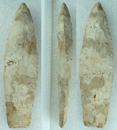
An Agate Basin paleo (ice age) projectile point- types studied by HNARP

6. How do you see a regional archaeological study different or similar to how consultant archaeology is conducted in Australia?

There are long term goals in the type of regional study that HNARP is doing, whereas consultancy based archaeology often does not share this goal and is a get in and out quick approach to archaeology.

7. What benefits did you see in a regional study compared to consultant archaeology?

There are many benefits. By developing relationships with landowners HNARP can give something to the community that consultancy often does not – that being a sense of communal ownership and responsibility for regional heritage. It sheds light on large areas and hunter-gatherer settlement patterns across time and space.

8. The HNARP works collaboratively and in co-operation with land owners to engage them in public archaeology to protect archaeological sites and artifacts from destruction and permanent loss. What opportunities are there to conduct similar practices in for archaeological sites and artifacts in Australia?

Much of our work involves working with Aboriginal people and mining companies to manage archaeological sites for a win-win solutions. Mining takes up land, and archaeological sites are so prevalent in the Pilbara region of Western Australia where I work that this involves destroying sites. Here the aim is ensuring everyone is informed on what is going on, and when sites are to be destroyed they are done so in a culturally sensitive manner and in line with legislative requirements.

9. What finals comments would you like to share with Silo readers about your experiences with HNARP?

It is not easy to tell people about the ins and outs of archaeology in a way they can understand what you are trying to achieve, but being a local Lorenz understands the landowner’s issues and communicates in a down to earth manner. He works to develop long term relationships with landowners. This is rare in archaeology, be it in Australia or anywhere in the world. We have lots of stone artefact sites in Western Australia, although we do not have the nice artefacts such as arrowheads you folks have. To see these local treasures being studied in a project that is solely funded by the researcher is again uncommon.

Archaeology is archaeology anywhere in the world, but people are people. They have interests and issues that should never be over-ridden in the pursuit of academic studies. With the goal to put archaeology back into the community, HNARP is unique and deserves local support. After all, who best to understand the Haldimand-Norfolk area than an archaeologist who was raised and grew up a local farmer. Thanks for this opportunity to share my experiences about archaeology in southern Ontario. CP


MTO Explain Archaeological Delays For Ontario Bridge

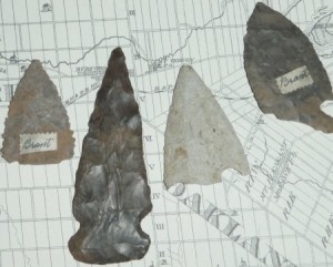
Eg's of type artifacts found in Cayuga area.
Eg’s of type artifacts found in Cayuga area.

Silo/HNARP- Can you tell our readers a bit about the history of the bridge, for example the year in which it was first built and its age?
The Grand River Cayuga Bridge is a 5-span through-truss bridge. Construction began in 1923 and was completed in 1924.

Silo/HNARP- So why is the bridge being redesigned and rebuilt?
To ensure our provincial bridges remain safe, Ontario is the only province in Canada to legislate that owners must inspect their bridges every two years by, or under the direction of a professional engineer. Taking it one-step further, MTO also conducts routine maintenance inspections of all 2,720 of our provincially owned bridges every year.
As part of our assessment, the Grand River Bridge, while currently still in safe condition, was identified as requiring future replacement, due to its age and declining condition. In 2005, the ministry initiated a Preliminary Design and Class Environmental Assessment (EA) Study to determine the long-term strategy for the bridge. Completed in 2008, the Study recommended the bridge be replaced with a 5-span, steel girder bridge. The Study received Environmental Clearance in November 2008.

Silo/HNARP- Can you explain to us the importance of archaeology to the MTO in Ontario and its support of the Heritage Act?
It is a requirement of the Ontario Heritage Act to address the impacts of any project on both archaeological resources and the built heritage environment, MTO achieves this as part of the Environmental Assessment we conduct for every MTO undertaking.

Silo/HNARP- Is the archaeology holding back the bridge’s development or is the project on schedule?
The ministry’s preliminary design and Class EA identified prehistoric and historic archaeological sites along the west side of the existing bridge, so it was acknowledged that some special measures and precautions would be necessary. The archaeological salvage work has been scheduled into the timeline of the project, and is on track.

Silo/HNARP- Did the MTO know in advance that extensive archaeological work was necessary?
The archeological assessment completed during the EA Study identified that prehistoric and historic archaeological sites are located along the west side of the existing bridge. Based on the results of a Stage 3 archaeological assessment (test trenches) completed during Preliminary Design, it was determined that a Stage 4 Archaeological Salvage had to occur to ensure existing artifacts are recovered before any areas are disturbed as a result of construction. In 2009, the ministry started the detail design study and retained a consultant (McCormick Rankin Corporation) and their sub-consultant, New Directions Archaeology Ltd., who are responsible for completing Stage 4 Salvage under an archaeological license issued by the Ministry of Tourism and Culture (MTC).

Silo/HNARP- The general public has noticed the excavation taking place one layer at a time. Why has this been important?
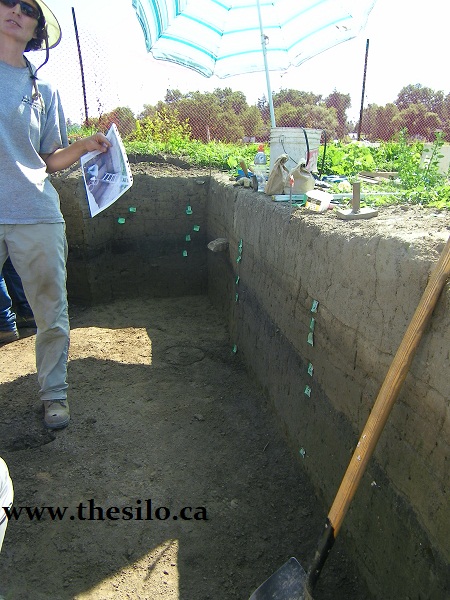
This is a very significant archaeological site made up of a series of cultural layers representing different historic and pre-contact occupations at this location. Based on previous studies, the artifacts range in age from the Archaic period, circa 8000 – 1000 B.C. through to the historic period circa 1700+ A.D. The west bank of the Grand River around Cayuga is a flood plain. Because the periodic flooding of the Grand River deposited silt over this flood plain, this site is made up of numerous levels of cultural material, each dating to a specific time frame, sandwiched between sterile layers of flood deposits. The goal of the excavation is to map and record these cultural layers before they are impacted by construction. To do this, the excavation is being completed in one metre by one metre squares, recording the original location of each artifact within the one metre square, including the depth at which it was recovered. The artifacts from each one metre square will be kept together, with individual levels kept separate in clearly identified bags. This will ensure that each artefact will be related to a specific cultural level and time period, to interpret the history of the site.
The excavation of each one metre square will continue downward until no further artifacts are recovered. Based on previous test excavation on the site, this will be at a depth of about 160 cm. The excavation will continue below this depth to ensure that all artifacts have been recovered, generally to a depth of approximately 180 cm (1.8 m).

Silo/HNARP- What unique discoveries have resulted at the site such as historic, pre-contact, archaic items?
The site is yielding an array of artifacts, including ceramics (pottery), tools (scrapers, spear points, arrow heads), stone flakes from tool making and even a shell bead, thought to be an early trading item.

Silo/HNARP- Why has the Six Nations been involved with this project?
First Nation involvement is an important aspect of this project because of the significant archaeological resources at this site. MTO and our consultants have regular and ongoing consultation with interested First Nations regarding this project. People from Six Nations have been hired for the archaeological field investigations and monitoring of the salvage operations, as well as the follow-up lab work.

Silo/HNARP- What will the MTO do with the artifacts once the project is finished. Will there be any public education about what was found?
Once the excavation of each one metre square is complete, the artifacts will be removed from the site and taken to a lab where they will be washed and organized. The artifacts will be analyzed and discussed in a final report including conclusions about the prehistoric activities at this site. Given the scope of this excavation, the analysis and reporting of this site will take years to complete. Once the report is finished, the artifacts will be kept for posterity, available for other archaeologists who are interested in the site and the time periods represented. Discussions are currently underway with a few Ontario university repositories to house the artifacts.

Silo/HNARP- How and where can the community learn more about what was recovered and learned from the excavation when the project is finished? Is there for example, an online PDF document, field report or analysis report of artifacts?
A report will be prepared after the artifacts are analyzed. The report may take a few years to complete, due to the size of the excavation. It will be filed with MTC and also provided to the First Nations having an interest in the site. Due to local interest, we also expect to provide copies to local repositories, such as the Haldimand Museum.

Silo/HNARP- Will this be the last season of field work before the bridge reconstruction gets started or is another field season anticipated in 2012.
It is anticipated that the salvage work at the current site will be completed in the fall of 2011. Additional areas of archaeological salvage may occur in 2012, if it is determined that construction activities will cause disturbance to additional areas on the west side of the river not yet salvaged.

Silo/HNARP- Who can be contacted to learn more about this archaeological site and its history?
The salvage work and report preparation are being conducted by New Directions Archaeology Ltd., under the direction of Mr. Phil Woodley. Questions about the site should be directed to the Communications Coordinator for MTO West Region (519-873-4186), who will consult with Mr. Woodley for detailed information as required.

Silo/HNARP- When is work expected to begin on the bridge replacement?
Construction is anticipated to begin in 2012 and is expected to take two construction seasons to complete.