Tag Archives: GRCA

River Water Levels Are Favorite Discussion Among Ontario Paddlers

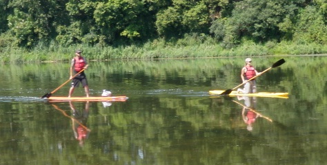
SUP- Stand up paddling is a popular sport along the Grand River system. image: grandriverrafting.ca

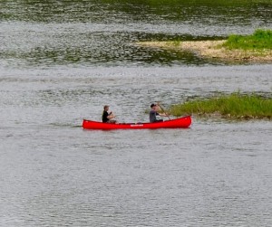
Is the water level in the river going to be okay for canoeing or kayaking on any given weekend?

This is a common question that people call the GRCA to ask. It is also an important question. Usually what  they mean is ” will there  be enough water?”, but occasionally, there is actually way too much water for most people to canoe or paddle safely.

Fly fishermen too need to check river levels so they are safe and don’t get swept off their feet by a strong current.

An angler will likely move to a different area rather than take a chance. As an organization, the GRCA does not make recommendations as to appropriate water flows for recreational activities along the Grand River and its tributaries because there are many variables to consider. Some people have the expertise and training to enjoy high flows that could be fatal to inexperienced and ill equipped paddlers.

Very low flows make for slow going as there may not be enough water for the canoe to float and it may need to be pulled to deeper water at certain times. A skilled paddler will be able to read the water to find the deepest water and will have fewer problems. Some people have a bad day if they have to step out of their boat even once, while others are more tolerant of low flows. That is why there is no definitive answer to this question.

Appropriate water levels are a favorite discussion among paddlers. Those who paddle regularly have their own personal chart, whether it is in their head or on a spreadsheet.

Checking flow information

Many avid river recreation enthusiasts in Southern Ontario bookmark the River Data section of the GRCA’s website and check it when trip planning. This is one of the most visited sections on the GRCA’s website and provides hourly updates on river flows from 39 gauges on the Grand and eight tributaries. Some gauge information is also posted on an Environment Canada website that includes rivers in other parts of Canada, but the GRCA site has data for more gauges from this
watershed.

The main chart here is called the Flow Summary.

Recreational users should pay attention to the column headed “flow.” This one is measured in cubic metres per second or cms. If the rate is 10 cms, that means that 10,000 litres of water is moving past the flow gauge each second at this part of the river. The cms gets bigger as the river moves towards Lake Erie. There are huge changes in river flow due to seasons, weather, ice jams and dam operation.

Compare this to the “summer lowflow” which is the average flow during the dry summer months and you will see in relative terms how much water is flowing down the river. Following this Flow Summary is a list of sections of the rivers and tributaries with graphs. For example, one of the most popular sections of the river for a day trip, Cambridge to Paris, a paddler would check the Galt gauge on the “Middle Grand River“section. The graph will tell you if the level is going up, down, or holding steady. Occasionally a flow gauge does not operate and the information can be inaccurate, so the information is provisional. There is also a River Flow Information line that is updated regularly and can be reached at 519-621-2763, ext. 2511.
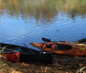
Photo by Judi Thompson

Outfitter information

There are several local outfitters in the area and they have cut off levels, when they stop canoe rentals. Canoeing the Grand in Kitchener has a safety section on their website with a five step rating chart for paddling. This scale  goes from “Excellent” to “No Go” with five levels, depending on the paddler’s age, skill, expertise and river conditions.
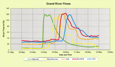
Grand River flow rates chart

When river flows skyrocket

As the graph above shows, the Grand River may not give much warning of a sudden increase in river flows, which is why the GRCA must sometimes issue high water safety warnings to the public. This is the flow information from the week of May 2 to 9 from a few years ago. Note that it shows heavy rain on Thursday night May 3 in the northern part of the watershed meant flows ballooned from 8 cms to 120 cms within a couple of hours, as the data from Marsville shows. The GRCA issued a warning after the storm. The rainwater gushed down the river and by the afternoon of Friday May 4, flows were dropping at Marsville but skyrocketing at West Montrose. By Saturday May 5, the river flows in Brantford were extreme and then they peaked at York on the southern Grand on Sunday.
A final important note, Dams can make the impact of a rainstorm less severe but they don’t eliminate flooding or high flows.

For the Silo ,Janet Baine, GRCA Communications Specialist
Barrett: Ontario Invasive Species Act Still Needs More Work

When sea lamprey became entrenched in the Great Lakes, the impact on native fish was tremendous. Decades later, we are still battling lamprey, but Asian carp are waiting at the door with ramifications that will make lamprey look tame.

Fallout on ecosystems and native species is often severe, and sometimes irreversible. The damage Asian carp could do to our Great Lakes is unimaginable and the phragmites invasion is choking out wetlands across the province. Damage from invasive species is not just ecological, but also financial with estimates of $7.5 billion annually on forestry and farming.

When passed, the province’s new Invasive Species Act will make Ontario the first province to have such a law. Basically, the bill lays out how to help prevent invasive species, how to detect and respond rapidly to the presence of new invaders, and effectively manage those already established. The concept is admirable, but I do have a few concerns.

The bill has wide-ranging support from various stakeholders, but it is reactionary when in many cases a more proactive approach would be appropriate.

To start, the identification of invasive species will be done through a so-called black list. It requires harm from a species before it will be regulated. However this is reactive rather than preventative. To explain further, the approach to sea lamprey is reactive, whereas the present approach to Asian carp is preventative. It’s easier and less costly to deal with an invasive species before it’s established.

An approach that is frequently recommended, but not used in this bill, is the pathways approach. Using this approach, the regulation of invasive species is based on the risk of invasion via certain pathways so it can be regulated and the risks mitigated. One example is requiring the gutting of all Asian carp imported into Canada for food to make sure they are dead.

The bill does not outline a science-based approach to risk assessment and decision making. My concern is red tape to identify invasive species will hamper prevention efforts.

The act downloads the responsibility of implementation to landowners, but leaves little incentive for landowners to act. As a property owner, I have concerns the bill will be punitive and unfair.

The bill creates two classes of invasives – significant threat and moderate threat. Although there are tools to deal with moderate-threat invasives in provincial parks, there are no tools or authority for private landowners. I have seen this in my own battle against phragmites on our farm and the limited tool kit permissable.

Another concern is the act would create a heavy-handed regulatory scheme that will punish innocent persons who have the misfortune of having an invasive species on their land and download costs of dealing with it to the owner. I am also opposed to the warrantless entry provision for authorities to search property and buildings.

The penalties set out in the act are higher for corporations than individuals. While this concept seems sound, the government failed to take into account the fact many businesses and family farms are incorporated.

I have faith in the science personnel within the Ministry of Natural Resources and Forestry who provided the basis for the act. But I also believe there is a wealth of knowledge amongst anglers, hunters, naturalists, farmers and commercial fishermen and their associations that can be incorporated with more public consultation. Toby Barrett, MPP

SupplementalGreat Lakes Commerical Fisheries Michigan Fish Producers Conference

Bill 167 Ontario’s Invasive Species Act 2014

Grand River Conservation effort targets phragmites- invasive reeds via Roundup

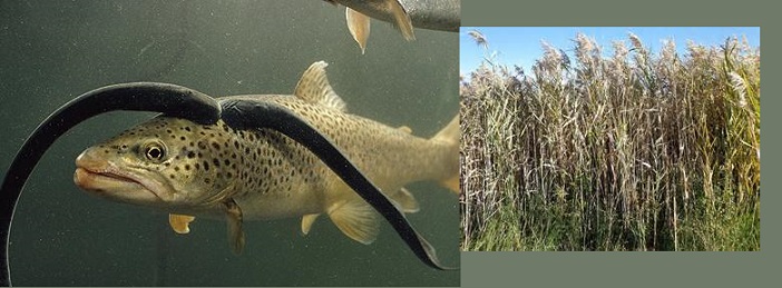
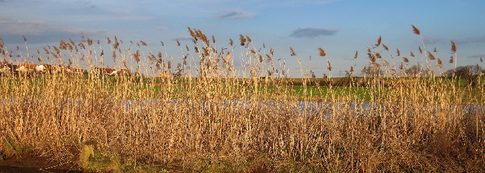
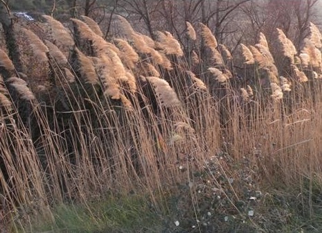
Phragmites

Portions of the Snyder’s Flats Conservation Area will be closed to the public during the week of Sept. 29 while a herbicide is used to control an outbreak of phragmites, an invasive plant species.

Signs will be posted in the parking lot at the entrance to the property on Snyder’s Flats Road near Bloomingdale. The affected sections of the trail network within the conservation area will be marked as closed.

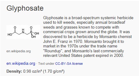
Staff of the Grand River Conservation Authority will be applying the herbicide glyphosate, which is better known by the trade name Roundup. The herbicide has been widely adopted by conservation organizations as a safe and effective way to remove invasive species.

What Is Roundup

The work is scheduled to be done on Monday, Sept. 29 and Tuesday, Sept. 30. The affected areas will be posted for a day after the herbicide is applied. There is a potential that the work could be delayed if there is heavy rain or high winds.

In most areas, the herbicide will be applied by hand to individual plants. Some larger outbreaks will be tackled with backpack-style sprayers.

Phragmites australis, also known as European common reed, is a species that came to North America from Eurasia. According to Ontario’s Invading Species Awareness Program, the plant spreads quickly and out-competes native species for water and nutrients. It releases toxins from its roots into the soil to hinder the growth and kill surrounding plants.

Phragmites: tough hombres!

In taking over from native plants, it also reduces the habitat available to wetland wildlife species including birds, turtles and other amphibians and reptiles.

GRCA staff  hope that by reacting quickly to its presence they can keep it from spreading throughout Snyder’s Flats and to other properties.

The work at Snyder’s Flats is part of the GRCA’s long-term program to return the former gravel pit area to a natural state that is home to a wide variety of plant, bird and animal species.

Click to view on I-tunes

Watershed Forests Returning On Former Farmer Fields

The Grand River watershed was 85 per cent forest 200 years ago. However, tree cover dropped to just five per cent by 1900 as land was cleared for farming and urban areas. Today, the tree cover has rebounded to about 19 per cent. Environment Canada suggests a healthy watershed needs a tree cover of about 30 per cent.

New forests are rising on old farm fields in Mapleton Township  in an effort to improve water quality in streams feeding Conestogo Lake reservoir.  About 70,000 trees are being planted this year and next on two parcels of land totalling 40 hectares (100 acres) on the north side of the reservoir.

The GRCA is planting a variety of species that are native to the area, including spruce, tamarack, white pine, bur oak, silver maple and cottonwood. In addition to the new forests, the GRCA will also do some reshaping of the landscape to create some seasonal wetlands that will also help improve water quality and provide additional habitat.

As the trees grow in coming years, the areas will quickly become home to a variety of animals, such as deer and wild turkeys. Later, as the forests mature, it’s expected that several bird species including scarlet tanagers, ovenbirds and great horned owls will take up residence. A 12 hectare parcel near Wellington Road 10 and Concession Road Five has been planted this year. The second parcel of 28 hectares is near Concession Road 5 and Sideroad 15. About 18 hectares has been planted this year and the rest will be planted in 2015. The land was acquired by the GRCA when it built the reservoir in the 1950s. It has been leased to farmers since then.

These two parcels of land were prone to erosion which sent a lot of sediment down the streams into the reservoir, explained Ron Wu-Winter, watershed forester with the GRCA. In addition, the sediment also carried nutrients – phosphorous and nitrates – which are found in manure and commercial fertilizers. The nutrients would spur algae and plant growth in the reservoir, resulting in lower water quality.

The northwestern part of the Grand River watershed contains some of the best farmland in Ontario. As a result, the forest cover is some of the lowest in the watershed. Forest cover is estimated at 15 per cent or less. A healthy watershed should have forest cover of about 30 per cent. Trees help raise water quality in several ways. They soak up nutrients in the soil, so reduce the volume that runs off the surface into a watercourse. Trees along a stream shade it, keeping it cooler in summer which is good for some coldwater fish species.

The total cost of the project is about $150,000. About $50,000 was contributed by the Grand River Conservation Foundation. It is also supported by the Trees Ontario Foundation which is contributing $65,000. For the Silo, Dave Schultz.

Tree Facts
* Across the entire watershed, the GRCA will plant about 400,000 trees this year, including 95,000 on its own land and 300,000 in partnership with private land owners.
* The GRCA operates a nursery near Burford, in Brant County, where it grows more than 150,000 trees a years from 60 different species.
* Since it was created in 1934, the GRCA has planted more than 27 million trees on both private land and its own land.
The Grand River watershed was 85 per cent forest 200 years ago. However, tree cover dropped to just five per cent by 1900 as land was cleared for farming and urban areas. Today, the tree cover has rebounded to about 19 per cent. Environment Canada suggests a healthy watershed needs a tree cover of about 30 per cent.
* To learn more about the GRCA’s tree planting program, go to the Tree Planting section of the GRCA website. The GRCA helps private landowners develop planting plans, plant the trees and find grants to offset costs.

Supplemental- Turning farm land back into forest- http://www.udel.edu/PR/Messenger/04/03/PTturning.html

Fish Quill Poetry Boat tour returns to the Grand River

Fish Quill 2013 - sponsor list


 Toronto, ON – A group of artists is setting out on a ten-day poetry and music tour by canoe down the Grand River in southwestern Ontario. For the fourth year running, the group, calling itself Fish Quill Poetry Boat, will be paddling from Elora to the Six Nations of the Grand River Territory and performing their work in cafés, arts centres, and heritage sites along the way. Fish Quill Poetry Boat in 2013 is comprised of poets David Seymour, Gillian Savigny, Leigh Kotsilidis, Linda Besner, and Stewart Cole, with London musician Grey Kingdom.


Fish Quill Poetry Boat will kick off the tour with a performance in Toronto on June 13th at 8pm at the TRANZAC Club. Scheduled stops for Fish Quill Poetry Boat are the Elora’s Beaver House on June 15th, West Montrose Kissing Bridge on June 16th, Waterloo’s Words Worth Books on June 17th, Cambridge’s Wired Up Pugs Café on June 19th, Paris’ Cedar House Martini Bar & Grill on June 20th, Brantford’s Station Coffee House & Gallery on June 21st, and Six Nation’s Chiefswood National Historic Site on June 23rd. With the exception of Toronto (8pm) and Elora (2pm) all performances are at 7pm. Cambridge’s performance has a $10 cover charge, and all other performances are free.

One notable stop on the tour is Chiefswood National Historic Site on June 23rd. Chiefswood is the only surviving pre-Confederation Native mansion in Ontario, and is the birthplace and childhood home of celebrated writer and performer

Tekahionwake, E. Pauline Johnson, best known for her iconic canoeing poem, “The Song My Paddle Sings.” The year 2013 marks the 150th anniversary of Pauline Johnson’s birth. Curator Karen Dearlove says, “We believe that the Fish Quill Poetry Tour is a great way to feature contemporary poetry and creativity at a site known historically for fostering literary creative dreams.” Fish Quill Poetry Boat will be sharing the stage at Chiefswood with local Six Nations writers and performers.

Fish Quill Poetry Boat is in its fourth year, and canoes are once again being lent free of charge by Paris-based outdoor adventure company Treks in the Wild. “A very cool idea,” says Andy Tonkin, canoeing guide and co-owner of Treks in the Wild, who will be coming along for the ride. The Grand River Conservation Authority and rare Charitable Research Reserve also sponsor the tour and will be giving presentations at select venues.

This year Fish Quill Poetry Boat has also put together an Indiegogo crowdfunding campaign. You can watch a video of Leigh Kotsilidis and Linda Besner explaining how the tour works-

As a reward for contributions made, donors to the campaign can receive perks, such an anthology of past and present Fish Quill Poetry Boat participants. So far, that’s fifty poets and musicians!   CP