Tag Archives: geology

Underwater Bimini Road Suggests Advanced Ancient Humans?

There is something very strange about the crystal blue waters in the Caribbean Sea, dotted with white sand islands and coconut trees, that seems to attract unsolved mysteries.

But unless the minds behind Wikipedia or mainstream science have a change of heart, the ever-mysterious underwater highway known as Bimini Road will likely remain case-closed.

Thereby hangs a tale common to throngs of mysterious places in the Atlantic Ocean east of the Florida Keys wherein ships, divers, and other witnesses speak of the unexplained—only to be scoffed at, derided, and scorned.

As with the Bermuda Triangle, Atlantis, and the fountain of youth, the Bimini Road joined the list of Caribbean enigmas when, in 1968, Joseph Manson Valentine, Jacques Mayol, and Robert Angove dove 18 feet underwater about a mile off of North Bimini, some 80 miles northwest of the Bahamas, and saw what they described as “pavement” on the ocean floor.

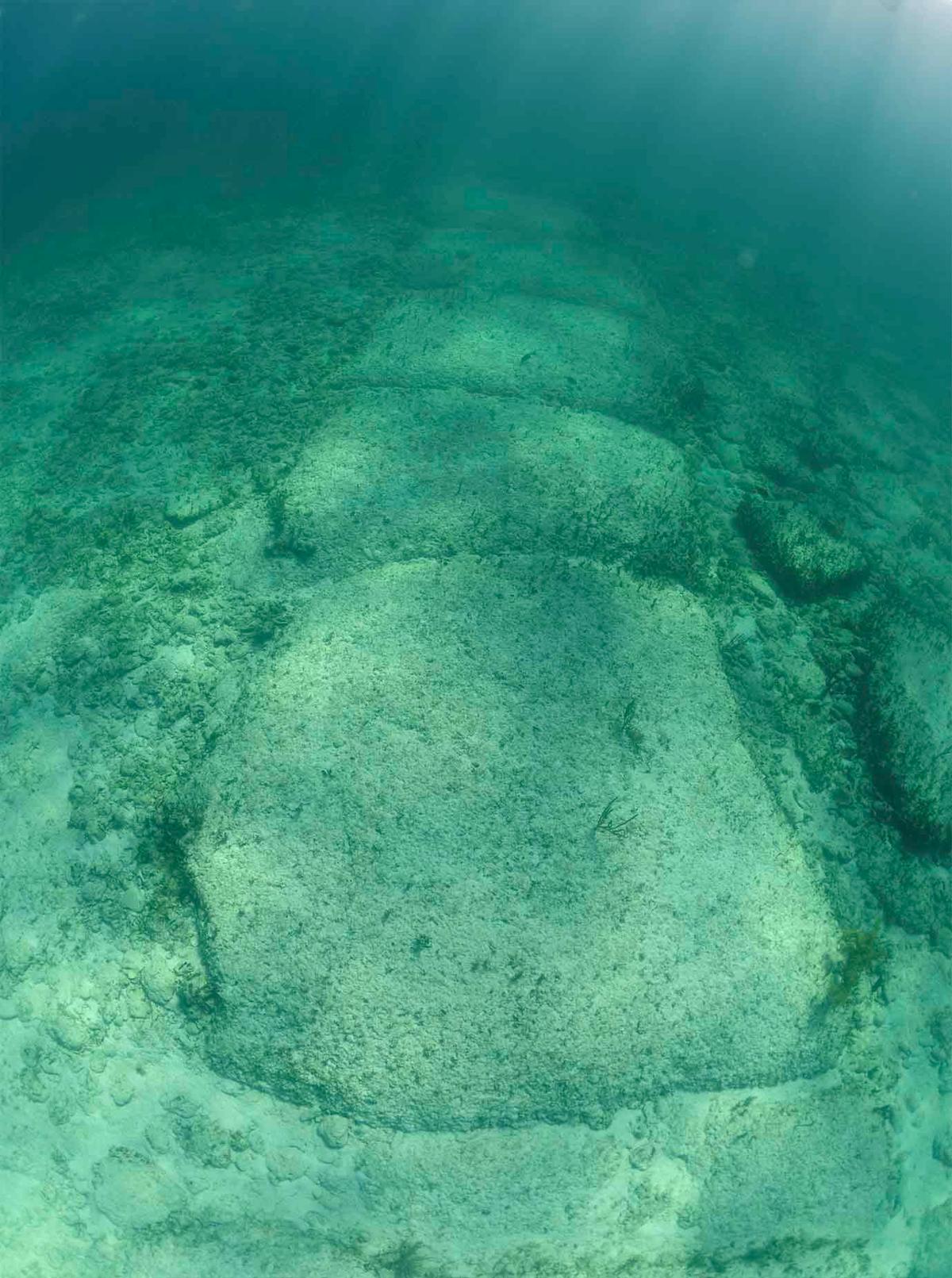
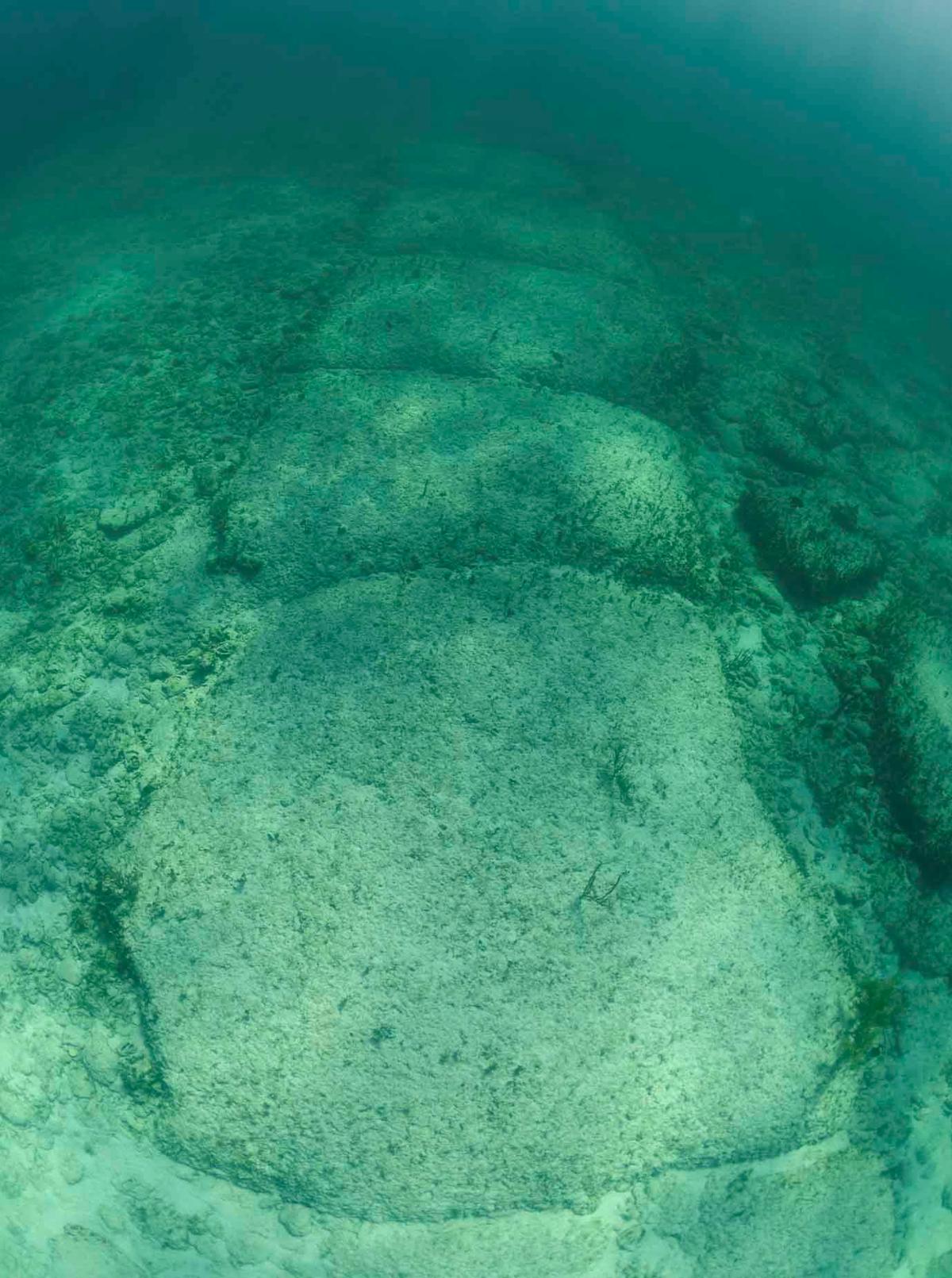
A host of roughly rectangular stone slabs, they reported, rounded like loaves of bread by the sand and current over centuries, formed a flawlessly straight line. Its main feature stretched over 2,600 feet and curved like a “J” at one end. There were two smaller line features. Megalithic in size, the blocks were each 7 to 13 feet wide with right angles and seemed laid level by human hands.

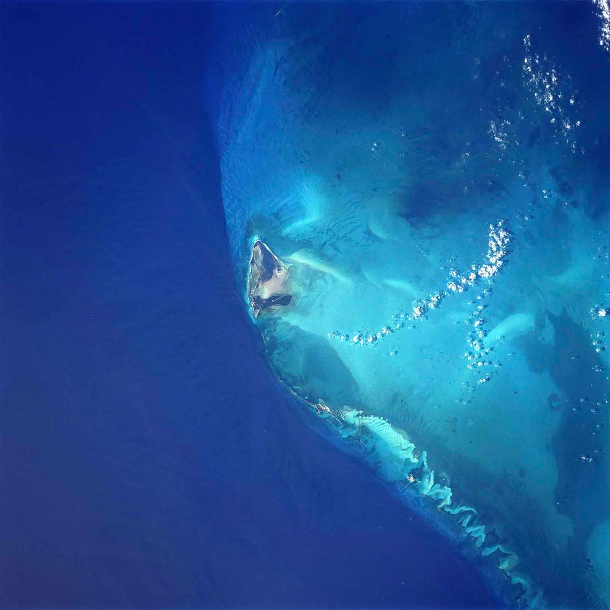
A satellite view of Bimini. (<a href="https://commons.wikimedia.org/wiki/File:Bimini_island.jpg">Public Domain</a>)
A satellite view of Bimini. Public Domain
A map of North Bimini showing Bimini Road. (Rainer Lesniewski/Shutterstock)
A map of North Bimini showing Bimini Road. Rainer Lesniewski/Shutterstock

The anomaly posed many questions to scientists.

How did it form? Was it made by man or nature? Could advanced civilizations have existed so early as to make this—in the Ice Age? Before the region sank beneath the sea 10,000 years ago? Or could nature have created something so fine-tuned? Thus began a clash of ideas.

There were two camps.

One dove down and saw a man-made road. Scientists and amateurs alike looked, and their eyes told them enough: this could not be natural.

The other camp was more skeptical. To avoid rocking the boat (figuratively speaking), they used science to explain the road to fit the foregoing research: it was natural.

As discoveries go, this one saw funded scientists fly in to investigate. Eugene Shinn from the University of Miami’s Department of Geology was foremost among them. Mr. Shinn dove down in 1978 and took radiocarbon core samples. Ultimately, he stated, it was beachrock—a mix of sand, shells, and cement—created by nature.

Megalithic blocks form a line on the seafloor off North Bimini. (FtLaud/Shutterstock)
Megalithic blocks form a line on the seafloor off North Bimini. FtLaud/Shutterstock

The so-called “consensus” of science that grew out of Mr. Shinn’s research, more or less, says this: Bimini Road formed under the surface of the island.

It was exposed by coastal erosion some 2,000 years ago. Its gaps at regular intervals were opened by natural jointing. This view is widely held and amplified on Wikipedia today.

The other camp is less uniform. Visiting Bimini Road, the notion was put forward: there was “overwhelming evidence that the road is made-made.” Their voices spoke from less lavish soapboxes: alternative media, websites, books, anecdotes. Much of it smacks of “New Age” and probably is sprinkled (or drenched) with misinformation to smear those brave voices speaking truth to orthodoxy. And there were voices whose minds changed.

Among the theorists, archaeologist William Donato suggested that Bimini Road isn’t a road; the line of stones forms a wall known as a breakwater, built to protect a prehistoric settlement from waves. This engendered its alter ego: Bimini Wall.

One of the strongest arguments for a man-made Bimini Road comes from Gavin Menzies’s (former British Submarine Commander and amateur historian) book, “1421: The Year China Discovered the World.” He writes: “Small stones are placed underneath larger ones, apparently to make the sea-bed level;” the structure “contains arrow-shaped ‘pointers’ that can only have been man-made;” and “some small square stones have tongue and grooved joints.”

Mr. Menzies, considered an outlier in both camps, believes ancient Chinese explorers anchored here and built the road as a slipway to repair a ship.

In 2022, British author Graham Hancock appeared on Joe Rogan’s podcast to discuss the road. He said it was artificially “propped up” and “leveled out” with smaller rocks. “When you dive on it,” he told Mr. Rogan, “it’s impossible to believe it’s entirely the work of nature.”

And there have been accounts that got their wires crossed.

Stones ranging from 7 to 13 feet in width pave the underwater road at North Bimini. (FtLaud/Shutterstock)
Stones ranging from 7 to 13 feet in width pave the underwater road at North Bimini. FtLaud/Shutterstock

Ironically, both Wikipedia and Mr. Menzies offer polar opposite arguments but cite the same man.

Mr. Menzies noted David Zink, who explored Bimini Road in 1974, mentioning “small stones” under the larger ones being a second layer beneath the Bimini Road. Wikipedia also cited Mr. Zink but with a reversal: the conclusion about this second layer “was likely incorrect.”

Amid all the clashing, we managed to obtain exclusive insight into the debacle.

Bimini Road, also called Bimini Wall, is believed to have been built to protect a prehistoric settlement from waves. (FtLaud/Shutterstock)
Bimini Road, also called Bimini Wall, is believed to have been built to protect a prehistoric settlement from waves. FtLaud/Shutterstock

Psychologist Greg Little, author of “Edgar Cayce’s Atlantis,” revealed to the newspaper another flip-flop. He claims to have evidence of scientists altering core samples to support that Bimini Road was naturally formed. He says they admitted being pressured to do so by “all the craziness” surrounding Bimini Road, that it was “done for fun,” and it was done “to make a good story.”

To verify Mr. Little’s claims, the scientist in question was contacted directly who replied they were “not going to nit-pick over Little’s concerns.”

If true, the claim raises questions: Why would the orthodoxy mislead? What do they stand to gain by disproving ancient man’s involvement in the creation of Bimini Road?

This was posed to Mr. Little, who drew on psychology to explain:

“All contradictions to their beliefs are probably perceived as a direct threat to them professionally and psychologically,“ he said. ”The long history of science has countless examples of widely held beliefs that were proven wrong by research. But even in the face of incontrovertible proof that these beliefs were wrong, many so-called scientists refused to accept the new evidence.”

As for Bimini Road—whether it’s case-closed, as the “consensus” says, or mysterious as ever—there’s perhaps a way to know: Visit Bimini Road. Swim the crystal blue waters. Witness its wonders yourself with your eyes. For the Silo via Michael Wing & friends at theepochtimes.com.

Fossil Shows Canada Had 400 Day Long Year

Haldimand and Norfolk Counties in Ontario, Canada have become an attractive area to explore for marine fossils.

The Great Lakes Basin, once inundated by a vast ancient, shallow sea that covered much of central North America, is today revealing an abundance of fossil corals, invertebrates, and marine organisms found within many limestone formations uncovered by glaciers and erosion.

Haldimand and Norfolk County have especially become an attractive area to explore for fossils of marine organisms by both scientists and amateur fossil collectors who can travel to local locations such as Rock Point Provincial Park near Dunnville, Ontario.

However, these fossils represent more than just evidence of unique life forms that once numbered in the tens of thousands of species co-existing in a marine ecosystem. They are scientific evidence of marine ecosystems in ecological transition, shifting continents, changing climates, and a record of our planets’ every day rotation around the sun.

Many fossil corals found in Haldimand and Norfolk County date around 410 to 360 million years ago. It is a time geologically known as the “Devonian Period”, the “Devonian Reef” or the “Age of Fishes”. During this period, fishes of many different species became abundant in the fossil record. A partly submerged North America, or as yet to be formed Great Lakes Basin, was colliding with Europe close to the equator. Reef building environments began to develop and produce some of the largest reef complexes in the world.

The reef complexes were in large areas of shallow equatorial seas that existed between the continents.

Evidence of a saltwater sea supporting a vast coral reef system once covering southern Ontario over 400 million years ago in the form of fossilized coral deposits support the theory that a coral reef system existed for a very long time. It was in the basins of these former shallow seas that great quantities of rock salt, gypsum, and other types of minerals precipitated, and today, mining industries dig well below the lowest depths of Lake Erie to recover these minerals.
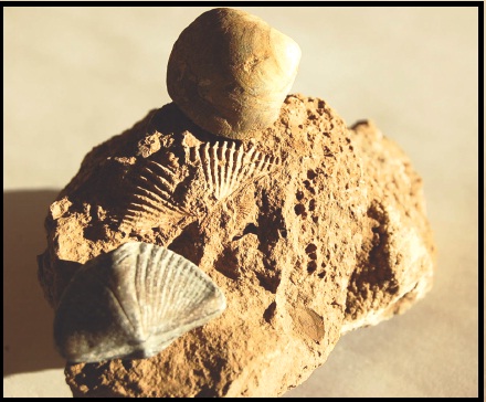
The “Heliophylum halli” is a fossil particular to the Great Lakes region and studies of its growth rings revealed 400 days in one Earth year when this coral was alive.

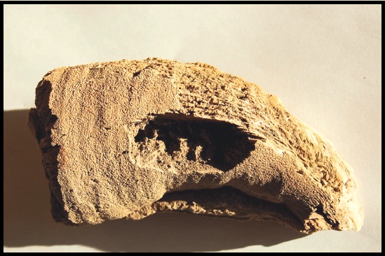
Exposure of reef basins varies and depends on how glaciers or water erosion has pushed or washed soil off bedrock. Under these conditions, a geologist’s field magnifying glass can help find very small fossils such as radiolarians and diatoms. Otherwise, larger fossils such as different varieties of bivalves (clams), trilobites, and even large fragments of fossilized coral are exposed. In some case, there are discoveries of fossilized marine organisms that are both rare and some times difficult to identify.

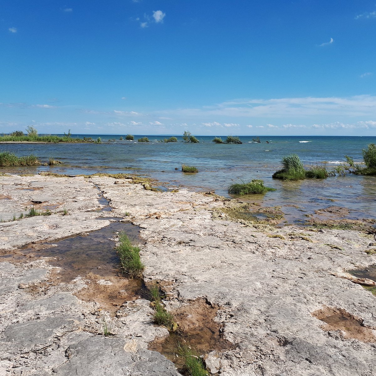
The fossilized remains of a Devonian Reef. Rock Point Provincial Park, Ontario.ROCK POINT PROVINCIAL PARK (Dunnville) - 2022 What to Know BEFORE You Go

What ended these reef complexes and created one of the greatest mass extinction events of earth’s biota was a combination of events that took place over a period of 25 million years.

Since species rely on a warm water marine ecosystem for their survival it would seem that a slow and gradual continental shift north from the equator would over time impact a large variety of marine species, including those supported by coral reefs. Therefore, events such as shifting continents, lowering of sea levels, climatic changes influencing land and sea ecologies, and/or possibly a glaciation had significant roles in the extinction of earth’s biodiversity.

Devonian Period - Geology Page
The large deposits of fossil corals and invertebrates found in Norfolk and Haldimand County has been of great interest to scientists and fossil collectors for many decades. However, fossil collecting took on a new importance in the last 50-60 years when it was determined there was a connection between growth rings of coral skeletons with the number of days in a year.

Scientists studying samples of coral skeletons from contemporary coral reef systems discovered growth rings on the outer surface of coral skeletons.

By studying a large sample of coral skeletons and determining how many growth rings represented a year’s growth of calcium carbonate, scientists were able to calculate an average of 360 rings per year. Thereby, approximately one growth ring represented one day’s growth for each day of the year. Taking this new information, scientists began collecting large numbers of exceptionally well-preserved coral fossils belonging to the Late Devonian Period. One particular species, found in the Great Lakes region, called a “Heliophylum halli” (see above) exhibited many growth rings developing in one year during this period. The result surprised even scientists.

Fossil coral showed there were approximately 400 growth rings per year 370 million years ago. Therefore, there were about 400 days in a year in the Devonian Period. Astronomers who have calculated that our earth’s rotation has been slowing at a rate of about 2 seconds every 100,000 years have since supported the new information.
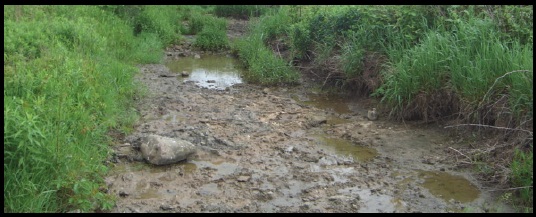
Exposures of ancient reef basins can be discovered in dried up stream beds and even under farmers fields.

Despite Haldimand and Norfolk County being a small example of a region once holding a thriving coral reef system, existing over 400 million years ago, the number of fossils of different species exposed is vast. Fossil corals, invertebrates, and species of marine organisms exist in many different shapes, sizes, and can be very fragile. Therefore, whether you are a scientist or amateur fossil collector, the next time you take a walk across the landscape to explore and search for fossils be sure to take along a fossil guide. You never know what new fossil discoveries you might make just walking across the countryside for an afternoon. For the Silo, Lorenz Bruechert.

Euro Holiday Destination Searches Skyrocket By 6700 Percent

As searches for “European holidays” skyrocket by 6700%¹, a must-visit list of the best cities in Europe has been announced. 

Our friends at Spin Genie  analyzed the average price and the number of days it would take to view the tourist attractions of major European cities to create a list of the 11 best places to visit in Europe. 

11 of the Best Places to Visit in Europe:

City Country Average Hotel Price (per night) Recommended Length Of Stay 
RomeItaly €70-€2005-7 days 
LondonEngland £100-£300 4-5 days 
Paris France €100-€300 4-6 days 
Amsterdam Netherlands €80-€2003-5 days
PragueCzech Republic €60-€1503-4 days 
BarcelonaSpain €80-€150 5-6 days 
SantoriniGreece €150-€3003-5 days 
BudapestHungary €70-€150 4-5 days 
ReykjavikIceland €100-€200 3-4 days 
Berlin Germany €70-€150 3-4 days 
ViennaAustria €80-€150 3-4 days 

Dom Aldworth, Head of Brand Marketing at Spin Genie says “As one of the most influential continents in the world, Europe is home to a vast range of diverse and culturally rich countries. From impressive historical architecture to quaint towns and delicious foods, every country offers travelers a unique and vibrant experience.

“Whether you want to indulge in fine French cuisine, relax in ancient baths or transport yourself back in time, Europe is the perfect place for bucket list adventures.”  

Dom continued “Budget-conscious travelers will be pleased to discover that several affordable cities offer incredible experiences without breaking the bank. 

“Budapest is often regarded as one of the most budget-friendly destinations in Europe. With its affordable accommodation options, reasonably priced dining choices, and inexpensive public transportation, visitors can explore the city’s stunning architecture, relax in its thermal baths, and indulge in its vibrant nightlife without straining their wallets.” 

The team also named their top 5 un-missable tourist attractions. 

Trevi Fountain, Rome


“One of Rome’s most famous landmarks, the Trevi Fountain is a bucket list attraction.” Dom at Spin Genie comments “Toss a coin into the stunning Trevi Fountain, one of Rome’s most famous landmarks. Admire its Baroque design, intricate sculptures, and cascading waters, and make a wish for your return to the Eternal City.” 

The London Eye and Tower Of London, London


London has a range of iconic landmarks, from historic buildings such as Buckingham Palace, Westminster Abbey and the Tower of London to Big Ben, Tower Bridge and the London Eye. 

Eiffel Tower, Paris


No visit to Paris is complete without a visit to the iconic Eiffel Tower. Ascend to the top for panoramic city views or enjoy a leisurely picnic in its surrounding gardens.

Bloemenmarkt, Amsterdam


The world’s only floating flower market, Bloemenmart is the perfect place for lovers of colour, beauty and flowers to visit. Admire colourful displays of flowers, bulbs and souvenirs and take home a piece of Amsterdam’s floral heritage. 

Santorini Volcano, Santorini


Take a boat trip to Nea Kameni’s and Palea Kameni’s volcanic islets. Hike up to the active volcano’s crater, bathe in the hot springs, and learn about the volcanic geology that shaped the island.

FAQs

What are the most beautiful cities in Europe?

Beauty is subjective; however, there are a few European cities that are renowned for their beauty.

Florence, the birthplace of the Renaissance, boasts a wealth of artistic and architectural treasures. The city’s historic centre is a UNESCO World Heritage site, and attractions like the Florence Cathedral, the Uffizi Gallery, and the Ponte Vecchio showcase its artistic grandeur.

Other beautiful cities include Paris, Prague, Barcelona, Amsterdam, Vienna, Santorini, and Rome.

What are the largest cities in Europe?

The largest cities in Europe by population include Moscow, London, Saint Petersburg, Berlin and Madrid.

Moscow, the capital of Russia, stands as the largest city in Europe, both in terms of population and geographical expanse. This thriving metropolis blends a rich history with modern cosmopolitanism. From the iconic Red Square and the majestic Kremlin to the opulent St. Basil’s Cathedral, Moscow showcases a fusion of grandeur, architectural marvels, and cultural treasures

What are the oldest cities in Europe?

Europe is a treasure trove of history, and it’s home to some of the oldest cities in the world. These cities have witnessed the rise and fall of empires, the birth of civilizations, and the shaping of European culture.

Plovdiv, located in Bulgaria, is one of Europe’s oldest cities, with evidence of settlement dating back over 8,000 years. The city’s Old Town, a UNESCO World Heritage site, boasts well-preserved Roman ruins, including an ancient theatre that is still in use today.

Other cities include Athens, Rome, Cadiz, Argos, Larnaca, and Byblos.

Which are the cheapest cities in Europe to visit?

Budget-conscious travellers will be pleased to discover that several affordable cities offer incredible experiences without breaking the bank.

Budapest is often regarded as one of the most budget-friendly destinations in Europe. With its affordable accommodation options, reasonably priced dining choices, and inexpensive public transportation, visitors can explore the city’s stunning architecture, relax in its thermal baths, and indulge in its vibrant nightlife without straining their wallets.

Some of the most affordable cities in Europe to visit include Krakow, Lisbon, Warsaw, Athens and Bucharest.

What are the safest cities in Europe?

Europe is generally considered safe, but some cities have lower crime rates than others.

Zurich, Switzerland’s largest city, is often ranked as one of the safest cities in the world. With its efficient public transportation system, well-maintained streets, and low crime rates, Zurich offers a safe environment for travellers to explore its beautiful Old Town, enjoy the pristine Lake Zurich, and immerse themselves in the city’s vibrant cultural scene.

Other safe cities include Copenhagen, Vienna, Helsinki, Stockholm, Munich, Amsterdam, Geneva and Oslo.

What are the most romantic cities in Europe?

When it comes to romantic cities in Europe, certain destinations evoke a sense of enchantment and timeless love. Paris, often called the “City of Love,” tops the list. With its charming cobblestone streets, beautiful parks, and stunning landmarks, Paris provides the perfect backdrop for romantic strolls, candlelit dinners, and unforgettable moments.

Other cities include Venice, known as the “Floating City,” which is a dreamlike destination that exudes romance; Florence, the birthplace of the Renaissance, captivates with its timeless beauty and artistic heritage; Santorini, a picturesque Greek island and Prague, with its fairytale-like architecture.

These cities have an irresistible charm that evokes romance and captivates the hearts of couples seeking a truly enchanting experience.

Prehistoric Trails Across Southern Ontario Farm Lands

Haldimand Norfolk Archaeology

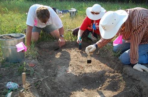
For over 25 years archaeological efforts have been ongoing to delineate where potential prehistoric trails exist across the landscape of southern Ontario.   Trails were created and used by the earliest inhabitants of the region after glaciers disappeared some 15,000 years ago.  One of the roles for a trail system was to help keep people alive.

The challenge to identify the existence of these trails is that they existed approximately 10,000 years ago.  The primary region for this research has been Haldimand-Norfolk County.  In the past seven years the search for prehistoric trail systems in these two counties has become increasingly intensive as part of the Haldimand-Norfolk Archaeological Regional Project (HNARP) http://www.hnarp.ca/ .

The premise of the regional project is to better understand how early people lived and managed their lives on a  landscape once rich with animal, plant, and raw resources such as rock for making stone tools.

A critical activity that has assisted this regional project is permission to walk over farm lands from supportive agricultural land owners to help find these trails.  Access to farm lands assists archaeologists to identify where people lived in the region.  The land mass of the two counties combined covers approximately 2,000 square kilometers.

Historically, it was always possible to read information written down and recorded about trails in the region.  This would include place names and popularly used trails.  Even oral history in Haldimand County by senior land owners some 30 years ago mentioned trails used by people to walk across the landscape to neighbouring farms, villages, and the shores of Lake Erie.

Haldimand Norfolk Archaeology

To date, archaeologists have identified artifacts left behind by people still exist after 10,000 years of changes to the landscape.  One piece of evidence has been the type of stone used for making tools.  Throughout the world people searched out different types of rock for making stone tools.

In Haldimand County, chert formations created over tens of millions of years ago can be found.  These chert formations have different identifying markers such as colours and fossils that make chert distinct from others.  It is these identifying markers that help chert to be identified from its original source and help to develop new evidence to show where and when people lived and crossed the landscape.

It is hoped that finding and identifying the different colour cherts and fossils in the rock will help archaeologists piece together Haldimand-Norfolk County’s long forgotten past.   For the Silo, Lorenz Bruechert.
Watch Live Stream Attempt Here By ESA Exo/Mars To Land On Red Planet This Wednesday

At about 17:30 CEST on 16 October, the data link with the ExoMars/TGO orbiter had still not been fully re-established following separation. Subsequently, at around 18:40 CEST, ESA (the European Space Agency) re-established a full data link with the spacecraft, and the mission control team could confirm that separation had taken place as planned, at 16:42 CEST. Both the Schiaparelli module and the TGO orbiter are in good shape and en route – separately – to arrive at the Red Planet on 19 October. We will be hosting the live video feed from ESA and wish them all the best of success in landing on Mars.

Schiaparelli Mars Rover

An orbiter carried on the ExoMars 2016 mission will hunt for methane in the atmosphere and show if it’s likely to have been generated by geology or biological processes. In other words- suggestive evidence of life/past life on Mars.

Share your smart device/phone/tablet/laptop/webcam video with us- or upload a Mars or space related file by clicking here: [vidrack align=”left”]