Tag Archives: Environment Canada

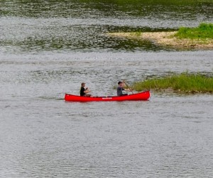
River Water Levels Are Favorite Discussion Among Ontario Paddlers

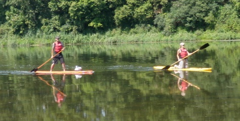
SUP- Stand up paddling is a popular sport along the Grand River system. image: grandriverrafting.ca

Is the water level in the river going to be okay for canoeing or kayaking on any given weekend?

This is a common question that people call the GRCA to ask. It is also an important question. Usually what  they mean is ” will there  be enough water?”, but occasionally, there is actually way too much water for most people to canoe or paddle safely.

Fly fishermen too need to check river levels so they are safe and don’t get swept off their feet by a strong current.

An angler will likely move to a different area rather than take a chance. As an organization, the GRCA does not make recommendations as to appropriate water flows for recreational activities along the Grand River and its tributaries because there are many variables to consider. Some people have the expertise and training to enjoy high flows that could be fatal to inexperienced and ill equipped paddlers.

Very low flows make for slow going as there may not be enough water for the canoe to float and it may need to be pulled to deeper water at certain times. A skilled paddler will be able to read the water to find the deepest water and will have fewer problems. Some people have a bad day if they have to step out of their boat even once, while others are more tolerant of low flows. That is why there is no definitive answer to this question.

Appropriate water levels are a favorite discussion among paddlers. Those who paddle regularly have their own personal chart, whether it is in their head or on a spreadsheet.

Checking flow information

Many avid river recreation enthusiasts in Southern Ontario bookmark the River Data section of the GRCA’s website and check it when trip planning. This is one of the most visited sections on the GRCA’s website and provides hourly updates on river flows from 39 gauges on the Grand and eight tributaries. Some gauge information is also posted on an Environment Canada website that includes rivers in other parts of Canada, but the GRCA site has data for more gauges from this
watershed.

The main chart here is called the Flow Summary.

Recreational users should pay attention to the column headed “flow.” This one is measured in cubic metres per second or cms. If the rate is 10 cms, that means that 10,000 litres of water is moving past the flow gauge each second at this part of the river. The cms gets bigger as the river moves towards Lake Erie. There are huge changes in river flow due to seasons, weather, ice jams and dam operation.

Compare this to the “summer lowflow” which is the average flow during the dry summer months and you will see in relative terms how much water is flowing down the river. Following this Flow Summary is a list of sections of the rivers and tributaries with graphs. For example, one of the most popular sections of the river for a day trip, Cambridge to Paris, a paddler would check the Galt gauge on the “Middle Grand River“section. The graph will tell you if the level is going up, down, or holding steady. Occasionally a flow gauge does not operate and the information can be inaccurate, so the information is provisional. There is also a River Flow Information line that is updated regularly and can be reached at 519-621-2763, ext. 2511.
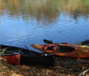
Photo by Judi Thompson

Outfitter information

There are several local outfitters in the area and they have cut off levels, when they stop canoe rentals. Canoeing the Grand in Kitchener has a safety section on their website with a five step rating chart for paddling. This scale  goes from “Excellent” to “No Go” with five levels, depending on the paddler’s age, skill, expertise and river conditions.
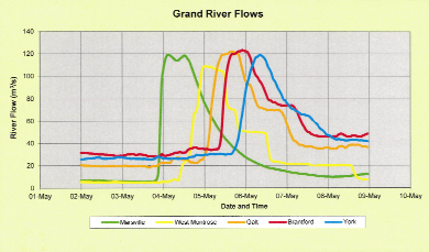
Grand River flow rates chart

When river flows skyrocket

As the graph above shows, the Grand River may not give much warning of a sudden increase in river flows, which is why the GRCA must sometimes issue high water safety warnings to the public. This is the flow information from the week of May 2 to 9 from a few years ago. Note that it shows heavy rain on Thursday night May 3 in the northern part of the watershed meant flows ballooned from 8 cms to 120 cms within a couple of hours, as the data from Marsville shows. The GRCA issued a warning after the storm. The rainwater gushed down the river and by the afternoon of Friday May 4, flows were dropping at Marsville but skyrocketing at West Montrose. By Saturday May 5, the river flows in Brantford were extreme and then they peaked at York on the southern Grand on Sunday.
A final important note, Dams can make the impact of a rainstorm less severe but they don’t eliminate flooding or high flows.

For the Silo ,Janet Baine, GRCA Communications Specialist
Chasing Ontario’s Tornados

Part One

I have seen many storms in my life. Most storms have caught me by surprise, so I had to learn very quickly to look further and understand that I am not capable of controlling the weather, to exercise the art of patience and to respect the fury of nature”

My name is Spencer Sills, and I am a storm chaser, some of you may remember a few years back reading about my good friend David Chapman and myself in this very newspaper and our journeys on the road to capture Nature’s fury through our lenses. Not much has changed since then, we are both still on the hunt for the elusive supercell and what fury may come with it.

In 2014 my overall goal to capture a tornado in Ontario was once again successful, on July 7th I teamed with Scott Burlovich of Restless Skies photography and his chase partner Harry for the day and we set out to capture some pulse storms that were flaring up in the afternoon, most of these cells were just rain makers but on the way back to my home I had noticed a wall cloud that was lit up by the sun, we pulled off to the side of the road directly South of Norwich and briefly documented a EF0 tornado in a farmers field before it lifted causing no damage since it was in a dry field. This was my only tornado of the year, in a busy season. I did however get to document several gorgeous storm cells throughout the year, including several beautiful stacked shelf clouds and a great Wall cloud early in the season that brought golf ball sized hail to the area.

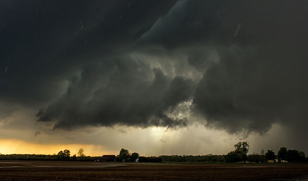
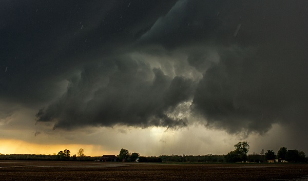
A Wall cloud in SW Ontario approaches my location as the RFD cuts around with hail starting to fall.

In 2015 I hope to achieve a few goals, one of which is to capture yet another tornado in this province, hopefully just like 2014 in an open field away from any properties. I also have set my sights on some goals with lightning and capturing it in a different perspective, I can’t go into much detail but it will be a stunning sight if I can achieve it. As far as how I believe the season will go, I do believe it will be a slow start, April and May will bring the return of storms, but I don’t expect anything too severe until June and July once the humidity and warmth really have a chance to build in. I do however once again stress to leave chasing to the pros, if you’re interested in storm spotting, please look into Canwarn, the more spotters in the province the quicker warnings can be issued thanks to verified ground reports.

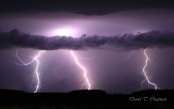
Lightning by Chapman

I will be working alongside another photographer and storm spotter this year, Scott Burlovich of Restless Skies, please feel free to check out his amazing work at restless-skies.com and give him a follow on twitter @restless_skies , you can also follow my journey for the year at Lightningfastphotography.com or on twitter @spencersills. I also want to send my best wishes to David Chapman for a great 2015, and as always look forward to meeting him in the field under the Meso, stay tuned for more updates and stay sky aware this summer!

Part Two

Another winter has come and gone, although perhaps slower than a lot of us would like. At least this means that the storm season is once again upon us in Ontario. As usual, Brian Chapman and I, a father and son chase team, will be back out on the roads looking for the best images of lightning and searching for Ontario’s tornadic super cells.

We will also be in close communication with our good friends and fellow chasers, Spencer Sills and Scott Burlovich, as we tend to share a lot of information about the biggest potential storms before we go chasing. You’ll notice when you look through their photography collections that they are a couple of the best for chasing down the biggest storms in our province.

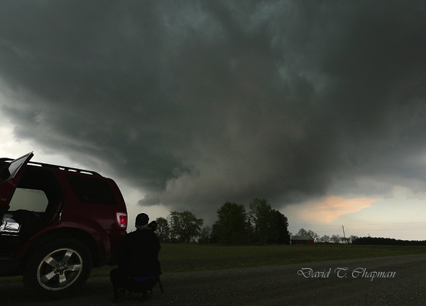
You might be curious on what we do when it comes to chasing the actual storm. Brian’s job is to be the driver. This is his first priority. Once we are parked and in a safe but photographic position for the storm, he is our main videographer. As for myself, I choose where I think the biggest storm will form from looking at weather models that meteorologists use as well as talking to fellow storm chasers in the area. I am also the main photographer. I do some video work and navigate us to the most photogenic side of the storm. This is usually right next to the most dangerous part of the storm but still in the safest position possible.

Rapidly Rotating wall-cloud photo being documented by Brian Chapman)

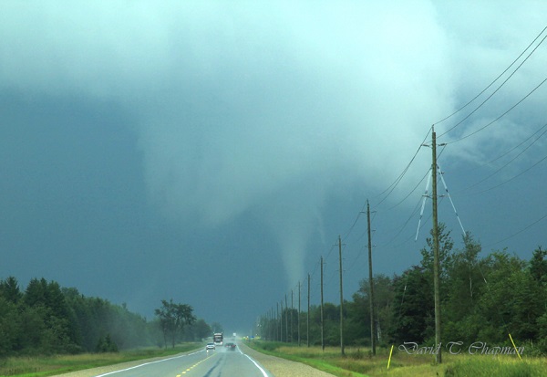
In the past 2 years, our team has seen and recorded a number of funnel clouds, 2 confirmed tornadoes and 4 waterspouts. One of the tornadoes was near Arthur, Ontario on August 7, 2013 and the landspout tornado was near Listowel, Ontario on May 14th 2014. The Arthur tornado was a really great one to document. It lasted for close to 15 minutes and we were able to see it from start to finish. The best part about it was the fact that  no one was injured and it caused very little damage. Those are the kinds of tornadoes we love to see because they allow you to enjoy the pure power and beauty that they possess but without injuries or major destruction.

Tornado by Chapman

Another thing that was interesting with the tornado that hit near Arthur was the fact that it tried to form a second tornado at the same time the first one was on the ground. If that funnel had reached the ground, it would have been called a satellite tornado. They are typically smaller and weaker but not always. In Pilger, Nebraska in 2014, two EF-4’s were on the ground at the same time. Sadly they hit a town, killing 5 people and injuring 19. Those are the days I dread as a chaser and hope I never see first hand. As for the second funnel near Arthur, it didn’t quite have the energy to make it the rest of the way to the ground. This probably wasn’t such a bad thing with so many people focusing on the main, larger tornado just to its north.

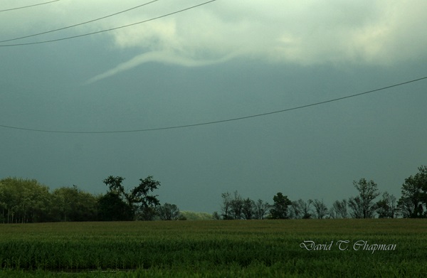
A Funnel Cloud
A Funnel Cloud

Fortunately, a lot of Ontario’s tornadoes hit open areas that cause little to no damage. There have been some exceptions, as the tornadoes that hit both Durham, Ontario on August 20, 2009 and Goderich on August 21, 2011 showed, both killing one person in each of them. That is why many storm chasers as well as dedicated weather enthusiasts in our province have a direct line to Environment Canada that allows us to contact them when we see threatening weather approaching the area we are in. It can help Environment Canada confirm what they are seeing on radar so that they can issue the proper watches and warnings accordingly. Refer to Spencer Sills’ Part One above for more details on how you can become a spotter. Lightning will also be a big focus for our team this year. We continue to work to get lightning photos as close as possible in order to capture the positive leaders that come up to meet the main negative current coming down from the cloud. The leaders can come from the ground, hydro poles, houses and even people.

Although this may be risky and dangerous, we have worked out ways to minimize the risk to us. We stay in the car when lightning is close with the windows up. We also won’t park under a tree, not so much from the fear of a direct lightning strike but in case lightning hits and splits the tree causing it to fall on the vehicle. I remember seeing one like that when I was young and it has had an everlasting impression on me. One of the first big wind storms I chased along Lake Erie on November 1, 2013 knocked down a tree onto a woman‘s car and unfortunately she was in it and was killed. So debris is always a concern and something to be very aware of when it comes to storm chasing.

You can follow our storm chasing throughout the year on our social media pages. https://twitter.com/DTChapmanPics https://www.facebook.com/pages/David-T-Chapman/173134962767601?fref=ts https://twitter.com/WeatherHunters

Toby Barrett
~CLICK ME~


Canada Methane Emissions Not Properly Regulated

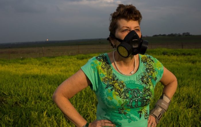
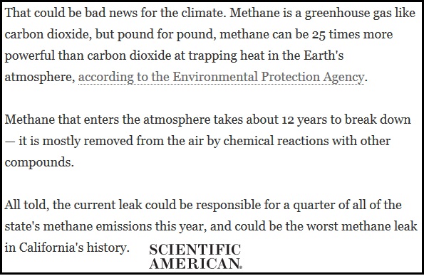
We need to take steps NOW to make sure Canada’s methane (aka Hydrogen Sulfide gas which contains up to 90% methane) emissions are being properly regulated. Methane is a greenhouse gas that is 84 times more potent than carbon dioxide – and its uncontrolled emissions affect everyone.

The solutions to reducing methane emissions are actually very simple – frequent leak detection and repairs, and replacing equipment that deliberately releases methane. The industry is resisting these solutions and pushing the Canadian government for weaker methane regulations. They want longer delays before regulations come into effect, as well as less frequent monitoring so that methane leaks go undetected for longer. And, they want to be paid for reducing methane emissions – so instead of polluters pay, the industry wants it to be pay-the-polluter.

Those who live in Alberta strongly agree that regulating pollutants like methane to the strictest North American standards is the right thing to do. If the province that would be most affected by these regulations feels this way, why aren’t we doing it?

Time is running out to make sure Canada’s methane emissions are strongly regulated. For the Silo, Dale Marshall.  Featured image- Les Stone /Greenpeace

Dale Marshall
National Program Manager

Watershed Forests Returning On Former Farmer Fields

The Grand River watershed was 85 per cent forest 200 years ago. However, tree cover dropped to just five per cent by 1900 as land was cleared for farming and urban areas. Today, the tree cover has rebounded to about 19 per cent. Environment Canada suggests a healthy watershed needs a tree cover of about 30 per cent.

New forests are rising on old farm fields in Mapleton Township  in an effort to improve water quality in streams feeding Conestogo Lake reservoir.  About 70,000 trees are being planted this year and next on two parcels of land totalling 40 hectares (100 acres) on the north side of the reservoir.

The GRCA is planting a variety of species that are native to the area, including spruce, tamarack, white pine, bur oak, silver maple and cottonwood. In addition to the new forests, the GRCA will also do some reshaping of the landscape to create some seasonal wetlands that will also help improve water quality and provide additional habitat.

As the trees grow in coming years, the areas will quickly become home to a variety of animals, such as deer and wild turkeys. Later, as the forests mature, it’s expected that several bird species including scarlet tanagers, ovenbirds and great horned owls will take up residence. A 12 hectare parcel near Wellington Road 10 and Concession Road Five has been planted this year. The second parcel of 28 hectares is near Concession Road 5 and Sideroad 15. About 18 hectares has been planted this year and the rest will be planted in 2015. The land was acquired by the GRCA when it built the reservoir in the 1950s. It has been leased to farmers since then.

These two parcels of land were prone to erosion which sent a lot of sediment down the streams into the reservoir, explained Ron Wu-Winter, watershed forester with the GRCA. In addition, the sediment also carried nutrients – phosphorous and nitrates – which are found in manure and commercial fertilizers. The nutrients would spur algae and plant growth in the reservoir, resulting in lower water quality.

The northwestern part of the Grand River watershed contains some of the best farmland in Ontario. As a result, the forest cover is some of the lowest in the watershed. Forest cover is estimated at 15 per cent or less. A healthy watershed should have forest cover of about 30 per cent. Trees help raise water quality in several ways. They soak up nutrients in the soil, so reduce the volume that runs off the surface into a watercourse. Trees along a stream shade it, keeping it cooler in summer which is good for some coldwater fish species.

The total cost of the project is about $150,000. About $50,000 was contributed by the Grand River Conservation Foundation. It is also supported by the Trees Ontario Foundation which is contributing $65,000. For the Silo, Dave Schultz.

Tree Facts
* Across the entire watershed, the GRCA will plant about 400,000 trees this year, including 95,000 on its own land and 300,000 in partnership with private land owners.
* The GRCA operates a nursery near Burford, in Brant County, where it grows more than 150,000 trees a years from 60 different species.
* Since it was created in 1934, the GRCA has planted more than 27 million trees on both private land and its own land.
The Grand River watershed was 85 per cent forest 200 years ago. However, tree cover dropped to just five per cent by 1900 as land was cleared for farming and urban areas. Today, the tree cover has rebounded to about 19 per cent. Environment Canada suggests a healthy watershed needs a tree cover of about 30 per cent.
* To learn more about the GRCA’s tree planting program, go to the Tree Planting section of the GRCA website. The GRCA helps private landowners develop planting plans, plant the trees and find grants to offset costs.

Supplemental- Turning farm land back into forest- http://www.udel.edu/PR/Messenger/04/03/PTturning.html